A460
| A460 | ||||||||||
| Location Map ( geo) | ||||||||||
| ||||||||||
| From: | Wolverhampton (SO915993) | |||||||||
| To: | Rugeley (SK034197) | |||||||||
| Via: | Cannock | |||||||||
| Distance: | 18.6 miles (29.9 km) | |||||||||
| Meets: | A449, B4156, B4484, M54, M6, A462, M6 Toll, A4601, A5, A34, A5190, A513, A51 | |||||||||
| Former Number(s): | B5013, A51 | |||||||||
| Old route now: | A449, A4601 | |||||||||
| Primary Destinations | ||||||||||
| Highway Authorities | ||||||||||
| Traditional Counties | ||||||||||
| Route outline (key) | ||||||||||
| ||||||||||
The A460 runs in a generally north-easterly direction across southern Staffordshire from Wolverhampton city centre to Cannock, and thence across Cannock Chase to the small town of Rugeley.
Route
Wolverhampton - Rugeley
The road starts at the Elephant and Castle junction with the A449 in Wolverhampton city centre, where the pub it's named after was demolished just as the signage containing the junction name went up!
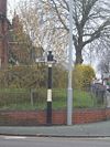
The route travels in a general north-easterly direction, past a couple of examples of old wooden direction signs in Fallings Park, and the oddly named district of “Scotlands”. The section within Wolverhampton is generally quite narrow, and has been made more so by the policy of placing pedestrian refuges in the centre of the road next to every bus stop.
It then travels out into the Staffordshire countryside with a small dual carriageway section just before meeting the M54 at junction 1. Care is required at this point, as there are several roundabouts on this stretch, including one to an industrial estate, where the exit from the estate is blind for travellers going away from Wolverhampton.
From the M54 northwards, this section is particularly busy, as it not only fills the gap between the M54 and the M6 (for travelling both to and from the north), but also to the M6 Toll beyond. The fact that this section also travels through the villages of Featherstone and Hilton only make the congestion worse. This section is best avoided if possible! There are plans to bypass this section:
Fortunately, M6 junction 11 is not far away, where we also meet the A462. The section north of junction 11 has been completely realigned with the coming of the M6 Toll, and is now a good standard dual carriageway between the two motorways. The old route is slightly to the east, but is now non-continuous. At M6 Toll junction T8, the original route carries straight on into and then through Cannock town centre, as the A4601. We'll see it again later!
The route turns sharp right, and runs alongside the M6 Toll, having been built at the same time, and now by-passes the notorious bottleneck of Bridgtown, and emerges at the Magic Gyratory at Churchbridge where we meet the A5, A34 and M6 Toll junction T7, all at the same place!
After Churchbridge, we head northwards along Cannock's eastern bypass, passing both retail parks and the local recycling centre, until we finally rejoin the A4601. We bypass Hednesford and meander our way through the forest of Cannock Chase, alongside the railway line to Rugeley.
At a roundabout on the edge of the town centre, the A460 splits to head left and right, finishing at both ends of the A51 Rugeley bypass. The road to the left (towards Stafford and Stone) is shorter (and primary); to the right (towards Lichfield and Alrewas) is D1.
History
The original 1922 route started at Princes Square in Wolverhampton city centre. It ran along Stafford Street which is now partially unclassified and partially A449 before joining the current start of the route at Elephant and Castle. It terminated on the A455 (now A34) in Cannock town centre. The road was extended over the route of the then-B5013 to Rugeley in the 1960s.
The next major change in the route of the A460 came in the late 1980s, when the construction of the Cannock eastern bypass saw the number applied to that road, with a multiplex along the A5 between Longford Island and Churchbridge, with the former section through Cannock town centre being given the number A4601, which must have taken hours and hours of thought to come up with.
Finally, in 2004, a new route was constructed at the same time as M6 Toll in the area, with a newly aligned dual carriageway between M6 junction 11 and M6 Toll junction T8, as well as a completely new route parallel to the M6 Toll directly linking the A460 to Churchbridge, removing the multiplex with A5.
There are three sections of former A460 caused by motorway construction in each case: the northern two being cut off by the M6 Toll, though not abandoned as there is housing and a farm along the old road. Further south, there is a small completely abandoned section just south of the M54, where the surface is still mostly intact though completely inaccessible except on foot.
In 2007, the A51 Rugeley bypass was built. As the A460 used to finish on the A51 it needed to be extended to meet the bypass. Unusually, it was extended along both sections of ex-A51 and so meets that road at both ends of the bypass.
Links
legislation.gov.uk
- The M54 to M6 Link Road Development Consent Order 2022 - This Order authorises National Highways to undertake works to provide a new road to link the M54 at junction 1 and M6 at junction 11 Hilton Park, Wolverhampton, Staffordshire and carry out all associated works.


