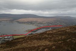
Caol Link Road
| Caol Link Road | |||
| Location Map ( geo) | |||
 | |||
| |||
| County | |||
| Inverness-shire • Argyll | |||
| Cost | |||
| Unknown | |||
| On road(s) | |||
| A82 • A830 | |||
The Caol Link Road is part of a greater scheme to speed traffic through Fort William. It is envisaged that it will start at the An Aird junction on the A82 in Fort William, and head north / north west to cross the River Lochy and reach the B8006 in Caol. From there, an additional section would be built across the Blar Mhor to meet the A830.
Why is it needed?
The argument in favour of this scheme is that the majority of traffic at the Lochybridge Junction where the A82 and A830 currently meet is travelling between the A830 and Fort William. Therefore by providing a more direct route traffic on the A82 through Fort William to Lochybridge will be reduced, so increasing traffic flows and journey times.
It will also add resilience to the local road network, as at present a closure between Lochybridge and the town will almost certainly mean a diversion via the A9, with the Corran Ferry and A861 only being able to carry limited volumes of traffic.
The Route
Starting at An Aird, the first section of the proposed route is already constructed as a dual carriageway, providing access to Morrisons Store and the rest of the An Aird development. A stub at the second roundabout shows the proposed onward route, passing between the Fire Station and Premier Inn to reach the banks of the River Lochy. This would be where the slightly less likely Fort William Northern Relief Road would branch off to cross the River Nevis and weave between historic and environmentally sensitive sites to rejoin the A82 somewhere near Lochybridge. The Caol Link Road, meanwhile, crosses the River Lochy.
As the River Lochy is not used by shipping larger than small rowing boats, a fairly ordinary concrete or steel girder bridge could be employed, although the fast currents (exacerbated by the outflow from the Aluminium smelter) and sandy river bed will provide some engineering challenges. On the north shore, a long spit of wilderness extends south from Caol, home to a sewage works and wildlife. This provides an easy route into Caol, which would be reached near Glenmallie Road. This road has a wide grassy strip on its south-eastern side left purposefully for the road.
Whether the road would re-use Glenmallie Road, or run parallel to it, with the existing road becoming residential access only is uncertain, as is the nature of the junction with the B8006. There is clearly enough land left for a roundabout to be installed however. In the various guises that this scheme has been reinvented in over the years, some have seen the new road stop here, simply doing as its name suggests. However, others see it continue northwards.
This takes us across the B8006, and follow the broad grassy swathe left alongside Broom Drive. However, as that road curves round we find a small block of houses built between Moor Road and St Johns Road. These are almost certainly on the alignment of the Caol Link Road, and are the first serious obstacle encountered. Neither of the existing roads are really wide enough, or in the right place to be utilised. Beyond the houses, however, is the Blar Mhor, a large area of peat bog due to be drained and developed in the next 20 or so years. Quite what route across the Blar is chosen will be down to the surrounding development, as the railway line could be bridged anywhere, and the A830 easily met almost anywhere. Perhaps the only consideration would be to bring the Blar Mhor Industrial Estate access to the same junction to minimise traffic disruption.
Will it get built?
As Fort William grows, and traffic volumes get higher, the problems of its road network only worsen. Serious queues in summer 2010 saw renewed calls for the Caol Link Road to be built, and with major new developments for the Blar Mhor now in the planning stage it seems inevitable that this route is once more being considered. The new development will eventually see some of the town centre functions moved / duplicated in the new development (Police Station, Hospital, Supermarket), but this will probably only see traffic flows reversed rather than reduced.
The quick answer is Who knows?, but with the road back in the public eye and on the political agenda it seems more likely now than in the last few years.
And a number?
If the route gets constructed to its full length, it will almost certainly become the de-facto mainline for A830 traffic. Presumably this will be recognised by the authorities and the road will become at the very least an A830 spur. However the fact that it will result in a new urban arm may see it left as non-primary for the Highland Council to maintain, especially as much of it is likely to be developer funder. The alternative is probably an extension to the B8004, or the creation of a re-routed or messy B8006.
| Caol Link Road | ||
| ||
| ||
|


