SABRE Maps/Scottish Popular Edition coverage project
| SABRE Maps Coverage projects | ||
| Location Map ( geo) | ||
| Pictures related to SABRE Maps View gallery (46) | ||
| Quick Links | ||
| Coverage Projects overview Fifth Edition • New Popular Edition • Popular Edition • Scottish Popular • Seventh Series • Landranger • Half Inch • Ministry of Transport • Quarter Inch • Ten Mile & Route Planning • OSNI One Inch • 1:25k First Series | ||
| Related Terms | ||
| SABRE Maps Co-ordinate Finder • Sheetfinder Online Grid Calibrator Adding maps in depth Map layer names • Georeferencing | ||
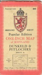
This SABRE Maps Coverage Project is to provide online coverage of the OS One Inch Scottish Popular Edition and associated maps such as the Trossachs and Loch Lomond Tourist sheet, which is technically a New Popular Edition sheet, but included here due to its Scottish location.
Whilst the Scottish Popular Edition was the equivalent of the Popular Edition of England and Wales and hence created just after World War 1, there were no One Inch Fifth Edition maps or standard New Popular Edition maps printed of Scotland, and the Scottish Popular Edition continued until the late 1950s.
The post-war Scottish Popular Edition is useful for us to have as it shows mapping at a relatively detailed scale during the post-war era up to the 1950s, when the One Inch Seventh Series coverage project comes into play. It is also the first mapping at the One Inch scale in Scotland to show road numbers, something that the pre-war editions did not, although "A" roads were marked (but without numbers) from 1935.
Currently therefore, it is these post-war editions that this Coverage Project focusses on at this time.
Which projection type are these maps?
Post-war revisions of the OS One Inch Scottish Popular Edition have the OSGB National Grid printed on them, but they actually use the Cassini (Delamere) projection and should be georeferenced accordingly. Using the National Grid only will result in poor alignment and the full map area not being available. The corner co-ordinates for georeferencing purposes can be found on the main Popular Edition information article.
Pre-war revisions do not have the National Grid printed on them, but are on the same Cassini (Delamere) lines.
However, Scottish One Inch Tourist Maps of the Scottish Popular period are horribly confusing. The post-war map of Loch Lomond and the Trossachs as mentioned above is actually a New Popular Edition based sheet, and so really is an OSGB National Grid map and should be geroreferenced as such, however its 1930s version is on Cassini (Delamere) lines and to add to the confusion, its 1920s counterpart is on the older Bonne (Scotland) projection; as are the majority of other Tourist sheets from between WW1 and WW2 unless stated. The exceptions are the Fifth Edition related sheets of Oban and The Cairngorms, which is only the 1936 edition (revision 4036) of the latter, which are National Yard Grid maps, whilst the Invergordon to Loch Ness sheet (revision 3200/33) looks similar to the Fifth Edition related sheets, but is actually on the Cassini (Delamere) projection.
| Name | Dates | Projection Type | Notes |
|---|---|---|---|
| The Cairngorms | up to and including 1933 | Bonne (Scotland) | |
| The Cairngorms | 1936 | National Yard Grid | Revision code 5036 only |
| Invergordon to Loch Ness | 1933 | Cassini (Delamere) | Very similar in appearance to Fifth Edition style sheets, but is surrounded by alphanumeric grid |
| Oban | 4036 | National Yard Grid | |
| The Trossachs and Loch Lomond | 1920s | Bonne (Scotland) | |
| The Trossachs and Loch Lomond | 1930s | Cassini (Delamere) | |
| The Trossachs and Loch Lomond | 1940s | OSGB National Grid | |
| All other Tourist sheets | Bonne (Scotland) |
How do I find out the date of the map?
Annoyingly, the OS didn't actually put the exact date of the map on each map. The date that appears on the map (usually with the words First published by the Director General at the Ordnance Survey Office) often is not the correct date of the map, but the date of the first revision of the map. Annoyingly, even where a seemingly obvious date is visible (such as "Roads 1946"), that does not tell the full story. For that, we need to capture the actual revision code found on the map.
Revision codes on post-war Scottish Popular Edition sheets can be found located right at the bottom left of the map sheet, underneath the margin texts, and can be either a numeric code (such as that shown to the left), a letter code (such as that shown to the right), or a combination of the two (such as 8046/Cr). Post-war Scottish Popular map revision codes are somewhat arcane and fall under three general groups:
- During the immediate postwar period the revision codes include the print run size and the year of printing, so 18046/Ch being 18000 copies, printed in 1946 at Chessington.
- During the late 1940s and early 1950s, the OS switched to a unique code per printing, so 2205 can be found on one sheet, with the next revision of that sheet being 2336.
- The final Scottish Popular maps have the familiar "letter codes" to indicate revisions, but generally they included the previous printings in their calculation. Just because there is an F revision doesn't mean that there is an E in existence!
Progress by every Post-War sheet ever printed
Note: There are no post-war revisions of sheet 89, as its area was covered entirely by New Popular Edition maps.
If two revisions were printed in a single year, then the one nearest to the centre of the year is listed as being from that year, and the other revision shifted into the earlier or later year as appropriate. Only standard civilian colour editions are listed. Some maps are not listed with their exact date within the best source available for dating, Richard Oliver's A Guide to the Ordnance Survey One-Inch Popular Edition of Scotland, published by the Charles Close Society, and in those cases the date has been inferred from the unique revision code.
Key
| Available on SABRE Maps | Online, but needs replacement source | Unconfirmed Revision | Within the pipeline | Pipeline (Military edition) |
Acquired but not scanned | Copy needed | In copyright (copy available) |
In copyright (copy needed) |
No map printed (or empty cell) |
| Sheet | Name | 1944 | 1945 | 1946 | 1947 | 1948 | 1949 | 1950 | 1951 | 1952 | 1953 | 1954 | 1955 | 1956 | 1957 | 1958 | 1959 |
|---|---|---|---|---|---|---|---|---|---|---|---|---|---|---|---|---|---|
| 1 | Yell and Unst (Shetland Islands) | 2201 | |||||||||||||||
| 2 | North Mainland (Shetland Islands) | 2202 | |||||||||||||||
| 3 | Central Mainland (Shetland Islands) | 2203 | |||||||||||||||
| 4 | South Mainland (Shetland Islands) | 2204 | |||||||||||||||
| 5 | Orkney Islands (North) | 2205 | 2336 | ||||||||||||||
| 6 | Orkney Islands (Mainland) | 2206 | |||||||||||||||
| 7 | Orkney Islands (South) | 2207 | |||||||||||||||
| 8 | Butt of Lewis | 2208 | |||||||||||||||
| 9 | Cape Wrath | 2209 | B | ||||||||||||||
| 10 | Tongue | 2210 | |||||||||||||||
| 11 | Thurso & Reay | 2211 | |||||||||||||||
| 12 | Wick | 2212 | |||||||||||||||
| 13 | Loch Roag and Tarbert | 2213 | |||||||||||||||
| 14 | Stornaway | 2214 | |||||||||||||||
| 15 | Lochinver and Loch Assynt | 2215 | B | ||||||||||||||
| 16 | Lairg and Loch Shin | 2216 | |||||||||||||||
| 17 | Helmsdale | 2217 | |||||||||||||||
| 18 | Harris | 2218 | |||||||||||||||
| 19 | Ullapool and Loch Ewe | 2219 | 2353 | ||||||||||||||
| 20 | Strath Oykell | 2220 | |||||||||||||||
| 21 | Dornoch | 2221 | |||||||||||||||
| 22 | Sollas | 2222 | |||||||||||||||
| 23 | Benbecula | 2223 | |||||||||||||||
| 24 | Portree and Dunvegan | 2224 | B | ||||||||||||||
| 25 | Raasay and Applecross | 2225 | A/ | ||||||||||||||
| Sheet | Name | 1944 | 1945 | 1946 | 1947 | 1948 | 1949 | 1950 | 1951 | 1952 | 1953 | 1954 | 1955 | 1956 | 1957 | 1958 | 1959 |
| 26 | Loch Maree and Achnasheen | 2226 | A/ | ||||||||||||||
| 27 | Strathpeffer and Invergordon | 2227 | B | ||||||||||||||
| 28 | Nairn and Cromarty | 2228 | B | ||||||||||||||
| 29 | Elgin and Keith | 2229 | B | ||||||||||||||
| 30 | Banff and Fraserburgh | 2230 | |||||||||||||||
| 31 | Peterhead | 2231 | |||||||||||||||
| 32 | Lochboisdale and Eriskay | 2232 | |||||||||||||||
| 33 | Bara and Mingulay | 2233 | |||||||||||||||
| 34 | The Cuillins, Rhum and Canna | 2234 | 2331 | B | |||||||||||||
| 35 | Sound of Sleat | 2235 | 2337 | B | |||||||||||||
| 36 | Lochcarron and Dornie | 2236 | B | ||||||||||||||
| 37 | Inverness | 2237 | 2348 | ||||||||||||||
| 38 | Grantown-on-Spey and Strath Dearn | 2238 | B | ||||||||||||||
| 39 | Dufftown and Huntly | 5046 | 2324 | ||||||||||||||
| 40 | Inverurie and Ellon | 5046 | 2310 | ||||||||||||||
| 41 | Glen Shiel and Glen Garry | 2241 | 2341 | ||||||||||||||
| 42 | Fort Augustus | 2242 | B | ||||||||||||||
| 43 | Kingussie | 2243 | 2332 | 2354 | |||||||||||||
| 44 | Ballater and Strathdon | 5046Cr | 2318 | 2342 | |||||||||||||
| 45 | Aberdeen | 4546 | 2311 | C | |||||||||||||
| 46 | Ardnamurchan and Loch Shiel | 2246 | A/ | ||||||||||||||
| 47 | Ben Nevis and Fort William | 2247 | 2338 | 2351 | |||||||||||||
| 48 | Loch Ericht and Loch Laggan | 2248 | B | ||||||||||||||
| 49 | Grampian Mountains and Blair Atholl | 2249 | 2343 | ||||||||||||||
| 50 | Glen Clova and Lochnagar | 3046 | 2315 | 2344 | |||||||||||||
| Sheet | Name | 1944 | 1945 | 1946 | 1947 | 1948 | 1949 | 1950 | 1951 | 1952 | 1953 | 1954 | 1955 | 1956 | 1957 | 1958 | 1959 |
| 51 | Stonehaven and Brechin | 4546 | 2319 | A// | |||||||||||||
| 52 | Coll and Tiree | 2252 | 2333 | ||||||||||||||
| 53 | Sound of Mull | 2253 | |||||||||||||||
| 54 | Loch Etive and Glen Coe | 2254 | 2325 | 2352 | |||||||||||||
| 55 | Killin and Loch Rannoch | 2255 | |||||||||||||||
| 56 | Dunkeld and Pitlochry | 2256 | 2326 | C | |||||||||||||
| 57 | Forfar and Dundee | 5046Cr | 2327 | A// | |||||||||||||
| 58 | Arbroath and Montrose | 4846/Cr | 2323 | C | |||||||||||||
| 59 | Iona and Colonsay | 2545/Cr | 2302 | ||||||||||||||
| 60 | North Jura and Firth of Lorne | 3045/Cr | 2316 | ||||||||||||||
| 61 | Oban and Loch Awe | 8046/Cr | 2328 | C | |||||||||||||
| 62 | Loch Katrine and Loch Earn | 4045/Cr | 2293 | C | |||||||||||||
| 63 | Perth and Strath Earn | 5046/Cr | 2320 | C | |||||||||||||
| 64 | Dundee and St Andrews | 5045/Cr | 2294 | C | |||||||||||||
| 65 | Dunoon and Loch Fyne | 4045/Cr | 2308 | ||||||||||||||
| 66 | Loch Lomond | 5045/Ch | 2312 | 2339 | |||||||||||||
| 67 | Stirling and Dunfermline | 5045/Cr | 2305 | C/ | |||||||||||||
| 68 | Firth of Forth | 5045/Cr | 2321 | C | |||||||||||||
| 69 | Islay | 5046/Cr | 2329 | ||||||||||||||
| 70 | Sound of Jura | 3045/Cr | 2317 | ||||||||||||||
| 71 | Island of Bute | 4045/Cr | 2299 | ||||||||||||||
| 72 | Glasgow | 10045/Ch | 2307 | 2340 | |||||||||||||
| 73 | Falkirk and Motherwell | 6045/Cr | 2292 | 2330 | D | D/ | |||||||||||
| 74 | Edinburgh | 10045/Cr | 2322 | 2349 | |||||||||||||
| 75 | Dunbar and Lammermuir | 9046/Cr | |||||||||||||||
| Sheet | Name | 1944 | 1945 | 1946 | 1947 | 1948 | 1949 | 1950 | 1951 | 1952 | 1953 | 1954 | 1955 | 1956 | 1957 | 1958 | 1959 |
| 76 | Kintyre | 3045/Cr | 2301 | ||||||||||||||
| 77 | Island of Arran | 3545/Cr | 2295 | 2347 | |||||||||||||
| 78 | Kilmarnock and Ayr | 8045/Cr | 2345 | ||||||||||||||
| 79 | Lanark | 5046/Cr | 2334 | C | |||||||||||||
| 80 | Peebles and Galashiels | 5045/Cr | 2313 | C | |||||||||||||
| 81 | Kelso | 8046/Cr | 2350 | ||||||||||||||
| 82 | Ailsa Craig and Girvan | 2545/Cr | 2303 | ||||||||||||||
| 83 | Loch Doon | 2545Cr | 2296 | ||||||||||||||
| 84 | Nithsdale and Moffat | 2546/Cr | 2297 | ||||||||||||||
| 85 | Hawick and Eskdale | 3045/Cr | 2300 | ||||||||||||||
| 86 | The Cheviot Hills | 5046/Cr | 2335 | ||||||||||||||
| 87 | Newton Stewart | 3046/Cr | 2304 | ||||||||||||||
| 88 | Dumfries | 3045/Cr | 2298 | ||||||||||||||
| 89 | Solway Firth and River Esk | ||||||||||||||||
| 90 | Stranraer | 3545/Cr | 2309 | ||||||||||||||
| 91 | Wigtown | 3545/Cr | 2314 | ||||||||||||||
| 92 | Castle Douglas and Kirkcudbright | 3545/Cr | 2306 | ||||||||||||||
| - | The Trossachs and Loch Lomond | 3388 |
Key
| Available on SABRE Maps | Online, but needs replacement source | Unconfirmed Revision | Within the pipeline | Pipeline (Military edition) |
Acquired but not scanned | Copy needed | In copyright (copy available) |
In copyright (copy needed) |
No map printed (or empty cell) |


