Stratford Broadway Interchange
| Stratford Broadway Interchange | |||
| Location Map ( geo) | |||
| |||
| Location | |||
| Stratford | |||
| County | |||
| Essex | |||
| Junction Type | |||
| Various | |||
| Roads Joined | |||
| M11, A11 | |||
Stratford Broadway Interchange was a potential southern terminus for the M11 during the early 1960s. At that time the M11 was planned to run along the Lea Valley starting at the Eastern Avenue Extension, now A12, at Temple Mills and head north along the river via Walthamstow. South of Temple Mills the route was known as the Docks Relief Road and was to head towards the Docks and the A13. The section between Temple Mills and Stratford contained a double bend to avoid some railway workshops which meant it couldn't be built to motorway standards. However British Rail was disposing of the workshops and the Ministry could purchase the land to enable the road to take a much straighter line. This would enable the road to be classified as M11 down to the then A11, now A118, at Stratford. It is not clear if the section further south to the A13 would also be a motorway.
At the same time investigations were made into what route a link from Bow Interchange to Temple Mills would take. Two routes were compared: A11 and Docks Relief Road via Stratford or A102 and Eastern Avenue Extension via Hackney Wick Interchange. The route via Stratford was hampered by the need to heavily upgrade the A11 and remove all the conflicting right turns. Having the M11 dumping its traffic there on its way into Central London didn't help either so the Hackney Wick route was chosen and eventually built.
A blow to a major junction at Stratford Broadway came when the Roding Valley route for the M11 was confirmed in November 1964. The southern terminus was still confirmed as Temple Mills but would now approach it from the east and a possible extension would be westwards to the Angel rather than southwards to Stratford.
The previous Lea Valley route was protected for a short time afterwards for a potential local road but it's not known what effect this would have at Stratford. And with the East Cross Route and M15 under development the Docks Relief Road was seen as an unnecessary duplication with no provision for cross river traffic.
Junction designs
Four potential junction layouts are known. They are detailed below
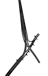
This is called Scheme B in the consultant's report about the southern section of the M11. This has the M11 curving southwestwards onto the A11 into Central London. The Docks Relief Road continues southeastwards towards the A13. Slip roads to and from the A11 north join the A11 at-grade as they would see a lower traffic flow than the London bound slips. This is common with two of the following designs.
This full cloverleaf is for a non-motorway route to Temple Mills. It allows movements in all directions but the geometry is poor with the loops being especially tight. Space is of concern as the central reservation on the Docks Relief Road disappears through the junction.
This design is for a motorway or non-motorway scheme. In the case it's the non-motorway scheme simply because the road to Temple Mills curves sharply. This junction appears to have provision for a southern continuation of the Docks Relief Road but at the expense of weaving on the southbound A11.
This layout is very similar to the half cloverleaf but removes the weaving from the A11 and improves the geometry of the southbound slip road onto the A11. The north facing slips are at-grade owing to potential fewer vehicles using them. The only flaw of this design is the lesser used slips take the mainline of the M11/Docks Relief Road to Temple Mills. Like the half cloverleaf it's based on there would appear to be allowances made for a southwards continuation to the A13.
Routes
| Route | To | Notes |
| Cambridge | ||
| Central London, Bow | now A118 | |
| Stratford, (Ilford) | now A118 | |
| Docks |


