A3049
| A3049 | ||||||||||
| Location Map ( geo) | ||||||||||
| ||||||||||
| From: | Poole (SZ004929) | |||||||||
| To: | Boscombe (SZ115921) | |||||||||
| Distance: | 8.6 miles (13.8 km) | |||||||||
| Meets: | A350, A35, A349, B3074, B3068, A348, A3040, A347, B3063, A338 | |||||||||
| Former Number(s): | B3061 | |||||||||
| Old route now: | A350, B3061 | |||||||||
| Primary Destinations | ||||||||||
| Highway Authorities | ||||||||||
| Traditional Counties | ||||||||||
| Route outline (key) | ||||||||||
| ||||||||||
For an earlier A3049 in Plymouth, see A3049 (Plymouth).
For the original A3049 near Portsmouth, see A3049 (Portsmouth).
Route
The A3049 is a road of many contrasts. It runs around the north of Poole as a major distributor road, and then around the north of Bournemouth as a local road. It connects the A35 in Poole to the same route in Boscombe, thus avoiding Poole and Bournemouth town centres, but isn't really a bypass. It was partially built as a major link road to the rest of the trunk road network, but was never completed - and the road is not now trunk.
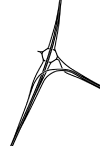
The road starts at Holes Bay Roundabout, heading eastwards, forming the continuation of the primary dual-carriageway road that started as the A35 Upton Bypass, became the A350 and now carries on as the A3049, as the A350 turns right to head into Poole. It shortly crosses over the A349 Broadstone Way, but doesn't connect to it, and then crosses the major Fleetsbridge roundabout (the busiest junction in Poole, with the A35 and a spur of the A349) on a flyover, but only partially connects to it. There are only east side sliproads, with the west side being catered for by the A35 junction a couple of miles back.
After Fleetsbridge, the road, now known as Dorset Way, heads up onto Canford Heath, passing a grade-separated junction with the local access for Canford Heath and Oakdale (with very tight sliproads) and up the hill to a roundabout junction with the B3061 Old Wareham Road. Taking the eastbound avoiding filter, the A3049 now heads north-eastwards, still along the edge of Canford Heath. Passing the Tower Park entertainment complex, with the huge concrete water tower, the road comes to another roundabout, junction with the B3074 and turns right to head eastwards again.
Entering Alderney, the speed limit drops to 40 and the road comes the Alderney roundabout where it meets the B3068 and turns left to head northwards. The next section of road up the hill to the Mountbatten Arms Roundabout is inconsistently mapped, with some maps showing it as part of the A348 and others as the A3049. If the road is the A348, then it is a useless multiplex for the A3049, because the A348 doesn't carry on any further. Signs claim it's the A3049.
At the top of the hill, at the Mountbatten Arms roundabout (although the pub on the corner has recently been renamed), the A3049 turns right as Wallisdown Road and the road carries on northwards as the A348. The A3049 is no longer primary and forms a local road for the rest of its length. From here until Boundary Roundabout, Wallisdown Road forms the boundary between Poole and Bournemouth, with the north side being in Bournemouth and the south side being in Poole. Initially the actual boundary is on the north side of the road, but it swaps sides just before the centre of Wallisdown, at the Canford Road turning – from here the boundary runs along the south side. Both University Roundabout and Boundary Roundabout are partially in both Poole and Bournemouth. With today's Unitary Authorities, this boundary makes road maintenance interesting.
After passing through Wallisdown and passing Bournemouth University (which is in Poole, causing huge consternation when it was named), the road reaches Boundary Roundabout, which is the junction with the A347, and is so-called as the road crosses here from Dorset into Hampshire. The next 200 yards is the A347 with the A3049 multiplexed, until the Talbot Avenue roundabout, where the A3049 turns off to head into Winton.
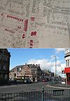
The road soon reaches the junction of Winton Banks, a busy little spot on the main shopping street of Winton, and named because there used to be banks on two corners (the NatWest is still there). The A3049 goes straight across into Alma Road, a long straight road typical of Bournemouth. It has a few pedestrian crossings and a traffic-light-controlled junction which was installed 15 or so years ago but with the old give-way markings still evident.
The road then crosses the B3063 Charminster Road, and continues straight east run along Richmond Park Road, before meeting the A338 Wessex Way at Richmond Park Interchange. Partially signal-controlled, the signals incorporate the fire station entrance, allowing the fire service a quick getaway when necessary. After the interchange, the A3049 takes a left onto Holdenhurst Road and then, shortly afterwards, a right at the lights into Ashley Road, with the Queen's Park pub on the corner.
This is the final stretch, heading into central Boscombe, and, after passing the gates of King's Park and crossing the railway, the road terminates on the A35 next to Boscombe bus station.
History
The A3049 was created in the 1950s to allow the Canford Heath part of Poole to be opened up for development. It initially started at Fleetsbridge roundabout and ran as a single-carriageway road up the hill as Old Wareham Road, following the course of today's A3049 and then what is now the B3061 to terminate on a small roundabout on the then-A348 (now the B3068): total length 1.8 miles and little hint that the road was to become a key to the strategic road plans for Poole and Bournemouth.
In the early 1970s, when the work to extend the A338 into Bournemouth as a town centre bypass had been started, the then-B3061, which ran from the Mountbatten Arms roundabout in Alderney to the A35 in Boscombe town centre, was renumbered as the A3049. The middle section between the two sections of road was along the A348 Ringwood Road.
At the same time, work was starting on the A35 Upton bypass, which had opened by 1974. Initially, this connected straight into Fleetsbridge roundabout, but around 1975, a new section of dual carriageway was built from the A35 at Upton House, running on reclaimed land along the top of Holes Bay and then crossing an enlarged Fleetsbridge roundabout on a flyover and feeding into the existing, single-carriageway A3049. This new road was classified as a western extension of the A3049.
In the early 1980s, the A3049 Dorset Way dual carriageway was built along the eastern edge of Canford Heath, joining the A3049 Old Wareham Road to the A348 Ringwood Road just south of the Mountbatten Arms roundabout. At the same time, most of Old Wareham Road was dualled (and renamed to be Dorset Way), with the remaining half mile or so renumbered as the B3061. The section of Ringwood Road connecting the new road to the Mountbatten Arms roundabout was also dualled. As the A348 north of the Mountbattern Arms roundabout had been dualled in the early 1970s, this gave a dual carriageway route all the way across Poole and was the fullest extent of the A3049. Nevertheless, there were still 3 missing sections of road in the overall strategy.
In the late 1980s, the first of these three missing sections was built, the dual-carriageway A350 Holes Bay road connecting the A3049 across the top of Holes Bay into the centre of Poole. As a result of this road, the section of A3049 from Upton House to the Holes Bay roundabout was reclassified as part of the A350, and the A3049 started where it does today, at the Holes Bay Roundabout.
The second and third missing roads were never built but explain the sudden right-hand turn on Canford Heath and the left-hand turn in Alderney. At the top of Canford Heath, the Ferndown relief road was supposed to connect the A3049 to the A31 at Ameysford, which explains why that road goes from dual to single carriageway. This was planned for the late 1980s but was cancelled due to environmental concerns. It was proposed again in 1993 as one of the options for the Highways Agency plan to improve links from the A31 trunk road into Poole, but this got cancelled in 1998 by the new Labour Government. The local authorities have tried to keep plans for this link open, but their plans have now changed into local improvements and no longer include this route.
The final section of missing road was the Wallisdown relief road, also planned for the late 1980s. At the Alderney roundabout, the A3049 was to carry straight on, as a dual carriageway, along the River Bourne valley to join the Branksome relief road from the end of the A338 Wessex Way, to run up to Boundary roundabout. The Wallisdown bypass scheme was highly controversial because the Bourne valley is a nature reserve and an SSSI. A public enquiry failed to come to a definitive conclusion, but after costs had increased to £70 million, the plan was eventually cancelled in 1998, mainly due to the environmental concerns.
The final change to the A3049 happened in the early 1990s when the Boscombe town relief road was built to allow the main street to be pedestrianised. This moved the A35 to run around the north side of the town centre and so the junction with the A3049 moved out of the town centre and onto this road.


