A337
| A337 | ||||
| Location Map ( geo) | ||||
| ||||
| From: | Cadnam (SU294135) | |||
| To: | Christchurch (SZ183937) | |||
| Via: | Lymington | |||
| Distance: | 21.7 miles (34.9 km) | |||
| Meets: | A31, A336, A35, B3055, B3054, B3058, B3059 | |||
| Former Number(s): | A3068, A3069 | |||
| Primary Destinations | ||||
| Highway Authorities | ||||
| Traditional Counties | ||||
| Route outline (key) | ||||
| ||||
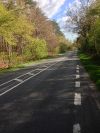
The A337, an L-shaped road in Hampshire, is a nice drive through the New Forest.
Route
The road starts in Cadnam at a roundabout junction with the A31 and A336. Contrary to what might seem obvious, it does not start further north at the A36 in Ower: that road is currently signposted "Cadnam A31" southbound, and "Romsey (A3090)" northbound and is a limb of the A31.
The first section runs southbound through the New Forest, with plenty of shade on a hot day. It multiplexes with the A35 around Lyndhurst on its one way system before continuing through the forest to Brockenhurst. Here it meets the B3055 from Beaulieu (home of the motor museum and cool vintage cars) and crosses the main Southampton to Bournemouth railway at a level crossing by the station.
The A337 leaves the New Forest just before Lymington where the B3054 branches off towards the Isle Of Wight ferry. At this point, it changes its southerly direction to head westwards instead towards New Milton. This half of the road is more suburban and less picturesque than the first half, though still a nice drive near to the South Coast with some good "pub grub" en route. It eventually meets up with the A35 again at a roundabout just outside Christchurch.
History
The A337 originally terminated in Lyndhurst, before being extended to Christchurch over the A3068 and A3069 in 1935.
The original route of the A337 in Cadnam started on the A31 northeast of the village, at the junction of Romsey Road and (now) Old Lyndhurst Road, crossing the A336 and following roughly a straight line to the current alignment, where it also met the B3077, which is now a track through the forest.


