A463
| A463 | ||||||||||||||||
| Location Map ( geo) | ||||||||||||||||
| ||||||||||||||||
| From: | Wombourne (SO881936) | |||||||||||||||
| To: | Willenhall (SO970978) | |||||||||||||||
| Via: | Sedgley, Bilston | |||||||||||||||
| Distance: | 7.1 miles (11.4 km) | |||||||||||||||
| Meets: | A449, A459, A4126, A4123, A4039, A41, A4444, A454, A462 | |||||||||||||||
| Old route now: | A462, A4039, B4464, B4484, B4590 | |||||||||||||||
| Primary Destinations | ||||||||||||||||
| Highway Authorities | ||||||||||||||||
| Traditional Counties | ||||||||||||||||
| Route outline (key) | ||||||||||||||||
| ||||||||||||||||
The A463 acts as an unofficial Wolverhampton southern by-pass, between the A449 to the southwest of the city centre and the A462 to the east. The route saw major changes in the late 1980s due to the construction of the Black Country Route access to M6 junction 10.
Route
Wombourne - Willenhall
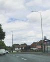
The route starts as a Non Primary Route at Wodehouse Roundabout with the A449 at Wombourne, southwest of Wolverhampton. The initial part of the route is a semi-rural, winding single carriageway that generally heads uphill into the small town of Sedgley, where at the Bull Ring in the town centre it meets the A459 on its way between Wolverhampton and Dudley. In order to continue along the A459, there is a short multiplex to the north before heading once again eastwards back down Hurst Hill to the junction with the A4123 at Coseley. This section is a poor standard urban single carriageway, and so often suffers from heavy traffic conditions.
Once again there is a short multiplex to the north, before the A463 takes the more modern dual carriageway Black Country Route again to the east, turning primary as it does so. There are several flat roundabouts on this section, including Spring Vale Island as the route passes across the former Bilston Steelworks site.
The A4039 joins at the large Coseley Road Island and the route then becomes a throughpass of Bilston after, running almost immediately to the south of the town centre to Oxford Street Island, where it meets the A41. As might be expected, this section of the route is extremely congested, especially with traffic accessing the large supermarket adjoining the south side of the road.
Beyond Bilston, the route widens out and becomes less congested, arriving on the line of the unconstructed Bilston Link Motorway just to the east of Vulcan Road Island. The large central reservation at this point hints at the cancelled motorway project, as does the uncompleted grade separation at The Lunt Junction where the A4444 Black Country Spine Road heads off south-east towards West Bromwich and M5 junction 1.
From this point onwards, the Black Country Route does actually gain its grade separation, though this is fairly useless to A463 traffic as, at the first grade separated junction, The Keyway Junction, the A463 leaves the Black Country Route (as the A454 takes over) and drops down to the roundabout below.
The final few hundred yards of the A463 are a simple non primary link road to meet the A462 which provides access to Willenhall and Darlaston (amongst other places).
History
Due to the arrival of the Black Country Route in the late 1980s, the A463 has seen a large change in the nature of its route east of A4123, although the modern route and the original route run roughly parallel.
As might be expected, the pre-Black Country Route A463 ran directly across the A4123 into Shaw Road, before following Biddings Lane, Anchor Road and Broad Lanes before crossing the site of Coseley Road Island into Coseley Road itself. It then turned east, passing along the main shopping street in Bilston town centre (High Street and Church Street) before splitting in two with eastbound traffic using Walsall Street to cross the former Wolverhampton Low Level - Birmingham Snow Hill railway line, whilst westbound traffic needed to take a short multiplex with the A41 along Lichfield Street before starting its journey down Church Street.
East of the A41, the two directions converged along what is now the B4484 via Mount Pleasant, Willenhall Road and across the old district boundary into Bilston Road. From the early 1970s to the 1990s, the A463 terminated at the Keyway. However, prior to that, it continued across the present location of the junction along Bilston Lane, Shepwell Green and Wolverhampton Road West (variously today parts of B4484, B4590, A462 and B4464) before terminating where it met the original line of A454 in County Bridge at the junction with Walsall Road.


