A509
| A509 | ||||||||||||||||
| Location Map ( geo) | ||||||||||||||||
| ||||||||||||||||
| From: | Milton Keynes (SP836384) | |||||||||||||||
| To: | Kettering (SP874774) | |||||||||||||||
| Via: | Wellingborough | |||||||||||||||
| Distance: | 30.6 miles (49.2 km) | |||||||||||||||
| Meets: | A5, A4146, A5130, M1, A422, A428, A5193, A45, A5128, A5193, A510, A14, A6003 | |||||||||||||||
| Former Number(s): | A50 | |||||||||||||||
| Old route now: | A5193 | |||||||||||||||
| Primary Destinations | ||||||||||||||||
| Highway Authorities | ||||||||||||||||
| Traditional Counties | ||||||||||||||||
| Route outline (key) | ||||||||||||||||
| ||||||||||||||||
For the similarly named road in Northern Ireland, see A509 (Northern Ireland).
Route
The A509 starts as one of the distributor roads in Milton Keynes before heading north through the towns of east Northamptonshire.
Milton Keynes - Kettering
The road begins on a grade-separated roundabout above the A5 just to the west of central Milton Keynes. It heads north-east as a dual carriageway, across the west-coast mainline to.... a roundabout. Get used to it - there are loads more to come. The A509 here is the Portway, also known as H5, and is one of the most important east-west routes in Milton Keynes as it runs just one block north of the main shopping centre.
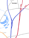
In the Northfield area of town we turn left at a roundabout where we gain primary status. The next roundabout is M1 junction 14, a large roundabout over the motorway. We continue north from here to another roundabout where we turn right onto a multiplex with the A422 round Newport Pagnell (with the A509 number dominant). It's a dual carriageway across flat, open countryside, very different from the new-town environment we've just been through. The dual carriageway ends with a wide central reserve at the approach to a roundabout (the last one for the time being), as if there were once plans to make this into a grade-separated junction. The A422 turns right here, but we head north, still on a relatively new bypass, until we reach the far side of Sherington where we rejoin the old route of the A509.
The road north is reasonably straight and fast past Emberton, but we slow down to enter Olney, just after crossing the River Great Ouse. We pass a roundabout with the B565 as we leave Olney, and continue on through Warrington (no, not that one) to a roundabout on the A428. The road remains flat and reasonably straight, and we bypass Bozeat so there is no need to slow down to pass through that village. We also bypass Wollaston, but we do need to slow down there as there is a roundabout with a minor road. We continue north past Irchester, then under the dual carriageway A45 to a roundabout on the south east edge of Wellingborough, where the straight-ahead route becomes the A5193, and we turn left to meet the A45 at a dumbbell junction.
We multiplex with the A45 around the south of the town, turning off the A45 at an at-grade roundabout surrounded by the sideslopes of the cutting that all three roads are built within. The road is initially single-carriageway, but this soon gives way to dual carriageway once again, at least as far as the roundabout with the A5128. Then it's single carriageway around the west side of Wellingborough, with occasional access to industrial estates, until we reach another roundabout where we turn left to resume the original route of the A509 heading north. The right turn here is the other end of the A5193 and straight on takes you onto the A510.
The road north bypasses a small housing area (Red Hill) but goes through the middle of Great Harrowden, a small village. We continue past Hill Top, reaching a height of 93 m, which I guess the locals would call a hill. It's down a dip then up again to the small village of Isham, but we miss Burton Latimer a mile or so to the east.
Then we reach the A14, passing across the grade-separated roundabout above the A14 at J9. There are a couple of short dual-carriageway lengths separating roundabouts which give access to retail parks. We then cross a railway before passing Wicksteed Park on the right on the way into Kettering. Shortly after, the road terminates at a T junction with the A6003 London Road / Barton Road.
Original Author(s): Simon Davies
History
The A509 originally started just northeast of Sherington Bridge, near Newport Pagnell, on what was the A422. The subsequent extension to the Portway dates from development of Milton Keynes during the 1970s.
The section from the south end of the Newport Pagnell Bypass to the M1 was originally part of the A506, which was renumbered as part of the A50 in the 1935 Road numbering revision.
Opening dates
| Month | Year | Section | Notes |
|---|---|---|---|
| Dec | 1985 | Wollaston Bypass | Opened on 11 December 1985 per the Land Compensation Act notice. |
| Dec | 1987 | Wellingborough: Redhill Improvement | The Redhill Way to Great Harrowden improvement was opened on 11 December 1987 per the Land Compensation Act notice. |
| Nov | 1988 | Wellingborough North West Bypass | Opened on 22 November 1988 per the Land Compensation Act notice. |
| Feb | 1989 | Bozeat Bypass | The 2 mile road was opened on 1 February 1989 per the Land Compensation Act notice. Opened by Bill Morton, County Council leader. Contractor was A. Monk Building and Civil Engineering Ltd., cost £3.3 million. |
| Feb | 1989 | Wellingborough: Turnells Mills Lane dualling | Opened on 10 February 1989 per the Land Compensation Act notice. |


