A5127
| A5127 | |||||||
| Location Map ( geo) | |||||||
| |||||||
| From: | Birmingham (SP076883) | ||||||
| To: | Streethay (SK145107) | ||||||
| Via: | Sutton Coldfield, Lichfield | ||||||
| Distance: | 16.8 miles (27 km) | ||||||
| Meets: | A38, A38(M), A4540, B4144, B4132, B4137, M6, A4040, B4139, B4142, B4531, A452, B4148, A453, A454, B4151, A4026, M6 Toll, A5, A5148, A461, A51, A5192 | ||||||
| Former Number(s): | A38 | ||||||
| Primary Destinations | |||||||
| Highway Authorities | |||||||
| Traditional Counties | |||||||
| Route outline (key) | |||||||
| |||||||
The A5127 is the former A38 between Birmingham and Lichfield, which has now been bypassed.
The number was originally allocated to the former A38 from the A5 at Wall to north of Lichfield when the Lichfield bypass opened in the 1960s, and hence correctly received a 5 zone number. Since then, a further bypass of Sutton Coldfield (which itself used segments of the A446 and A4097) and the creation of the A38(M) Aston Expressway have taken the A5127 out of zone.
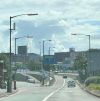
The road starts on the A4540 Birmingham Middleway at its J13, where the A38 becomes the A38(M). The A5127 begins as the motorway slip roads before turning away. The northbound carriageway then crosses the motorway and the two carriageways meet in time to cross the B4144 at a roundabout. The road then continues along the D2 Lichfield Road through Aston, as the non-motorway alternative to the A38(M). After going under the railway line by Aston station the central reservation disappears but it isn't long before we go under the M6 to meet Salford Circus, the roundabout part of M6 J6, where we can gain access to the motorway or the northbound A38. As part of the array of slip roads that gives this junction its nickname there is also free-flow access between the A5127 to/from the north and the A38(M).
We continue north away from Spaghetti Junction and become D2 once all the slip roads have sorted themselves out. We climb the residential Gravelly Hill and soon cross the A4040 Birmingham Outer Ring Road at the Six Ways roundabout. There's then a brief dual section as we bypass the centre of Erdington (which was bypassed before the A5127 existed). Back to S2 we continue along the suburban Sutton Road and soon cross the A452 at traffic lights.
After passing through Wylde Green the A453 comes in from the left at traffic lights and now the A5127 is the dominant partner in a multiplex (presumably it's the fact we used to be the A38 that gives us priority). We enter Sutton Coldfield town centre and join a one-way loop at a roundabout. Northbound traffic follows Brassington Avenue, which was built specifically as a relief road and which skirts a multi-storey car park for most of its length. After passing a road leading to the station we reach traffic lights where the mainline of the A5127 TOTSOs left. Ahead is the southbound section of the loop, which follows previously existing side roads to the east of the town centre, with the southern section having a contraflow bus lane.
Heading north out of Sutton the A5127 bears left into the High Street and crosses over a freight railway line. The A453 regains its number by turning right at traffic lights and we continue north along Lichfield Road. The A454 then turns left at a roundabout and we go over the Cross City Line by Four Oaks station. The A5127 continues through the suburbs and finally leaves Birmingham city limits at Watford Gap, at a roundabout where it meets the A4026.
The road now becomes rural, although there are still a few houses on this stretch. The road then skirts the eastern edge of Shenstone before reaching the M6 Toll. The westbound onslip for JT5 turns off to the right before we cross the motorway to reach a roundabout on the A5, where we are joined by southbound traffic from the A5148. We cross over the motorway offslip (which only allows access to the A5148) to the next roundabout where the A5148 turns right, the A5 turns left and we continue ahead. The next turn left, signposted to Wall, is the original line of the A5.
We go under a low bridge on the Cross City Line and soon reach a roundabout on the A461 which here is bypassing Lichfield. We become urban on the far side and head into the city centre along Birmingham Road. There's another low bridge just before a roundabout where we meet a spur of the A461 and the A51. Here we bear right along what was the A38 but which is now signed as the mainline of the A51. That road leaves us by turning right at the next set of lights and we pass Lichfield City station and skirt the city centre before heading out of town along Trent Valley Road. The A5192 northern bypass is crossed at a roundabout. Turning right along that road provides access to the southbound A38. We continue ahead past Lichfield Trent Valley station to cross the West Coast Main Line. We continue through the village of Streethay before the two carriageways split to form the slip roads to/from the northbound A38, making this the end of the A5127.


