A6/Kendal - Penrith
| A6 | |||||||||||||
| |||||||||||||
| From: | Kendal (SD520932) | ||||||||||||
| To: | Penrith (NY514303) | ||||||||||||
| Meets: | A685, B6261, B6262, B5320, A66, A592 | ||||||||||||
| Highway Authorities | |||||||||||||
| Counties | |||||||||||||
| Route outline (key) | |||||||||||||
| |||||||||||||
After leaving the mess of the new, improved Kendal one-way system, the A6 heads off due north, keeping its primary status.
Slightly off-topic: there are three routes out of Kendal that meet with the M6 - namely the A6 (to junction 39 near Shap), the A685 (to junction 38 at Tebay), and the A684 (to junction 37 near Sedbergh). Traditionally, the A6 and A685 were primary routes, the A6 signed for Penrith and the A685 for Brough. The A684 was essentially a local route, of fairly poor quality heading towards the northern Yorkshire Dales, and had secondary status. I believe that Kendal was signed only from the southbound M6 at junction 38 via the primary A685. This state of affairs seems to change regularly. From the s/bound M6, Kendal is now signed from all three junctions, but bizarrely, primary status now seems to reside only with the A684. This is the shortest route to the M6 (5 miles), but is not a good route. Large vehicles cannot use it anyway because of the low railway bridge on the A684 in Kendal town centre, and have to follow a local diversion down narrow residential streets. I assume that the granting of primary status means that this is to become the preferred route from/to the M6, and the signs (from Kendal, and on the M6) may be changed at some point to reflect this. As it stands at the moment, if you are heading down the M6 from Carlisle, you will still directed off at Shap onto the A6.
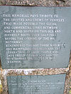
It is all uphill from Kendal, for a long slog up to Shap, a bleak village high up on the edge of the Cumbrian Mountains, or to be more precise the Shap Fells Range. This route was long-feared by lorry drivers passing between England and Scotland (this was of course the principal route to Scotland from the western half of England until 1971 when the M6 finally bypassed it), because of the devilishly long climb (and descent when coming home). Many vehicles didn't make it, and my grandad (who used to drive lorries) has testified to the number of wrecked vehicles he saw on this route (or in the valley below!), particularly during winter. There are a number of vicious bends (many of which were improved over the years), and this was (and is) a legendary piece of road to many. There is a monument at the summit in memory of those who used to have to traverse this route.
The summit is some way short of Shap itself, and the road has started to descend again before we reach the B6261, which itself acts as a spur of the A6 down the junction 39 of the motorway. The A6 loses primary status north of the B6261 and does not regain it until the outskirts of Carlisle.
After leaving Shap, we pass under the M6. There is no junction here, but until 1971, this was the starting point of the M6 Penrith bypass, which opened in the mid 60s - once the missing link from the then M6 terminus at Carnforth opened, the access was closed off, and there is now no sign whatsoever that the M6 used to start and end here.
The A6 refuses to let go of the M6 from now on, and crosses it a further two times in the next three miles. It drops down to Eamont Bridge which was a notorious bottleneck in the early 60s. There is a narrow humped-back bridge here over the River Eamont which is traffic light controlled - apparently (even in the 60s) there were notorious jams here; the same problem occurred one mile further north in Penrith town centre where the main street which carried the A6 had a narrow section which was light controlled. According to the Lancashire Motorway Archive site, these were the reasons why the Penrith bypass was considered a priority, and one of the earliest sections of the M6 to open.
I notice from a new OS Explorer map of the NE Lakes purchased last week, that the route of the A6 has now been changed through Penrith. The old route has been downgraded to unclassified route, with the A6 now multiplexing with the A66 as far as M6 J40 (so the A6 gets to meet its new friend again here now as well), then doubling back along the former A592 back into the centre and resuming its old course - might be a good time to update the A592 Roads by 10 entry to now end on the A66 at Stainton just west of the M6.


