A6/Lancaster - Kendal
| A6 | |||||||||||||||||||
| |||||||||||||||||||
| From: | Lancaster (SD480623) | ||||||||||||||||||
| To: | Kendal (SD520932) | ||||||||||||||||||
| Meets: | A683, A589, B5321, A5105, B6254, A601(M), A6070, B5280, B6384, A590, A591, A65, A684, A5284, A685 | ||||||||||||||||||
| Highway Authorities | |||||||||||||||||||
Lancashire • Westmorland and Furness | |||||||||||||||||||
| Counties | |||||||||||||||||||
Lancashire • Westmorland | |||||||||||||||||||
| Route outline (key) | |||||||||||||||||||
| |||||||||||||||||||
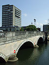
Two bridges carry the A6 over the Lune, the river which gives its name to the city. Northbound traffic uses Greyhound Bridge, which was converted from a redundant railway bridge in 1972. Southbound traffic uses Skerton Bridge, built in 1788.
The A6 crosses over the A683 Bay Gateway (Heysham to M6 link road), completed in 2016.
We then leave towards Carnforth, and the fringes of Morecambe Bay, as the A6 passes at some points close to the coast. Carnforth is a bit of a bottleneck, although this is caused simply by the lights at the crossroads in the centre of the town, where the narrow streets do not permit extra lanes for turning traffic.
Shortly after leaving the town we reach a roundabout and truck stop marking what was the end of the 1960 Lancaster bypass. Except that the M6 was extended north in 1971 from a point one mile to the east, so until the late 80s we had a spur of the M6 reaching the roundabout, this roundabout becoming known as J35A of the M6. Then a short link to the B6254 was built so that quarry traffic could join the M6 without going through Carnforth, and the rest is history - voilà, we get the A601(M).
After a very short dualled stretch (presumably to allow M6 traffic in the 1960s to "adjust" to life back on an A-road for what would now be a bit of an ordeal of a journey), we leave Lancashire, into Westmorland, and before long reach Milnthorpe, another little coaching town similar to Carnforth, but a bit more picturesque. After Milnthorpe, a nice run brings us to Levens Hall, a bridge over the River Kent, and what used to be a simple junction with the A590 heading off to the left to rejoin what was the detached bit of Lancashire, and Barrow-in-Furness. Now, we are forced to turn left onto the A590, and dog-leg around to the right to join the new A590 dual carriageway which brings us to the junction with the A591 at Levens. Southbound, the A6 follows its original route.
The A6 has now, to all intents and purposes, vanished. To pick it up again, we must follow the A591 for Kendal and Windermere. This dual carriageway forms part of the main route to the Lakes from the south, and links in with a bypass of Kendal. As previously mentioned in my A591 "Roads x10" posting, this must be a very rare example of a three digit A road taking precedence to a multiplexing single digit A road.
After about 2 miles, we reach the Kendal bypass, and the A6 reappears, but you have to turn off to reach it.The A6 regains primary status here for the first time since leaving the M55.
Long standing Sabre members will recall an earlier discussion about the extravagant one-way system in Kendal town centre, presumably designed many years before the M6 was extended north, in order to keep traffic moving. In particular, Chris had noticed how, on a recent trip to the Lakes, the A6 south of the town was signed "South Kendal", with the A591 directing "Penrith (A6)" traffic along the bypass. I commented in reply how daft this was, as the bypass didn't rejoin the A6 north of the town, and A6 traffic heading for Shap and Penrith was simply directed to turn back on itself onto the A5284 and head back into the town centre, rejoining the A6 at the top of the main street, but still on the one-way system.
Having passed through Kendal on my travels last week, I couldn't help but notice the new traffic (mis)management system introduced at the end of April (and which is very unlikely to still be there next April!). Oh dear - what were they thinking of! Various roads at the top of the town centre loop (as Leeds Council would no doubt have called it) have been converted into two-way traffic, and one very narrow street down the side of the town hall has had its flow reversed. All this so that northbound A6 traffic can be diverted away from the top of the main street and complete an extra little loop through more twisty streets, rather than simply following the nice three lanes-wide main street.
If they were pedestrianising the main street, then this might make some sense. However, it doesn't seem that this is happening. One reason that I can say this is that the narrow little street which now carries the northbound A6 has a 7.5T weight restriction. So heavy vehicles have to use the original, direct route up the main street.
This is a mess frankly. I cannot think of any other example of the heavy vehicles "diversion" being shorter and more direct than the route everyone else follows! Only it probably isn't shorter because new traffic lights have been installed at the top of town which clearly leaves traffic following the "old A6" at a disadvantage, as only three or four cars can get through at one go. You then have a wait of perhaps 2 or 3 minutes for the rest of the cycle to complete.
At the moment, it is chaos because most people are not following the new route, but simply carrying on as normal. With the change in traffic light priority, long delays are building up in the town centre - presumably the exact opposite to what as intended.
I can't comment on any other changes that might have been made, as I only briefly passed through, but I did hear on the local radio station that the whole of Kendal is up in arms and the bods from the council who dreamt up this scheme are very much on the defensive, and conceding that the scheme may in fact be "experimental". Time will tell...


