Star.pngStar.pngStar.pngStar grey.pngStar grey.png

A6127

From Roader's Digest: The SABRE Wiki
Jump to navigation Jump to search
A6127
Newcastle Collins.JPG
Cameraicon.png View gallery (14)
From:  Chester-le-Street (NZ272501)
To:  Blakelaw, Newcastle upon Tyne (NZ216667)
Via:  Birtley & Gateshead
Distance:  12.6 miles (20.3 km)
Met (1986) A167, A693, A69, A6125, A6115, A692, A695, A186, A6127(M), A6125, A189, A6082, A696
Former Number(s):  A1, A696
Now part of:  A167
Traditional Counties

Durham • Northumberland

Route outline (key)
A6127 Chester-le-Street - Newcastle upon Tyne
A6127(M) Newcastle Central Motorway East
A6127 Newcastle upon Tyne - Blakelaw

Route

The A6127 was what replaced the A1 from the centre of Chester-le-Street through Birtley and Low Fell and eventually over the Tyne Bridge to Newcastle's Central Motorway, which was then called the A6127(M).

For a description of the modern day incarnation of this route see the A167 article.

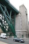
Approaching Gateshead on the A167 (former A6127)

At its fullest extent, the A6127 started on the A167 to the south of Chester-le-Street and headed north along Durham Road into the town centre. It ran along Front Street and left town along Newcastle Road. After crossing the A693 northern bypass it continued north through Birtley before crossing the A69 Gateshead bypass. The road continued north through Low Fell into Gateshead itself. It passed to the east of the town centre along the Gateshead Highway before crossing the Tyne Bridge into Newcastle upon Tyne.

The road passed to the east of the city centre along the A6127(M) Central Motorway East, crossing the A6125 Great North Road at the far end. The road then passed to the south of the Town Moor before bearing right into Ponteland Road and ending on the A696 Springfield Road. That road then continued ahead along Ponteland Road.

History

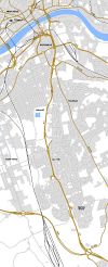
Birtley in 1956, showing the A6127 through town and the A1 bypass

The A6127 first came into existence around 1930 following the construction of the A1 Chester-le-Street bypass. The road vacated, through the town centre, became the A6127, which was therefore a short road linking the A1 to itself.

The construction of the A1(M) through Durham saw the old A1 renumbered A167 south of Chester-le-Street. As this road took on the 1920s bypass it was the A6127 that took over the old A1 to the north of town. For some years its northern end was at the northern end of the Birtley bypass, by where the Angel of the North is now. However, when the A1 was diverted away from Newcastle upon Tyne through the Tyne Tunnel in 1977 the A6127 took on its route north through Gateshead and into Newcastle. North of here, however, the old A1 became the A6125 and so the A6127 was diverted west along what was the A696.

When the A1 moved again, after the opening of the Newcastle western bypass in the 1990s, the A6127 number was discontinued and the road was made an extension of the A167; however that road remained on the 1920s Chester-le-Street bypass and so the old A6127 through the town centre was declassified; this has allowed Front Street to be closed to through traffic.

Several maps incorrectly show the A6127 as still existing as the road through Birtley; however these are mapping errors.


A6127
Junctions
Roads
Places
Related Pictures
View gallery (14)
Durham Road heading into Gateshead town... (C) Trevor Littlewood - Geograph - 3691872.jpgA167 Gateshead Highway. - Coppermine - 1345.JPGTyne-br1.jpgThe Great North Run under way - Geograph - 994895.jpgGateshead 1968 proposals.jpg
Other nearby roads
Chester-le-Street
A1(M) • A167 • A183 • A693 • A1053 (Chester-le-Street) • B1284 • B6290 • B6313 • E15 • E31 (via Newcastle) • M100 • T1 (Britain)
Gateshead
A1(M) • A69 • A167 • A184 • A185 • A185(M) • A189 • A194(M) • A195 • A613 (Gateshead) • A692 • A1114 (Gateshead) • A6081 • A6082 • A6083 • A6084 • A6115 (Tyneside) • A6125 • A6126 • A6171 • B601 • B1288 • B1295 (Gateshead) • B1296 • B1296 (Gateshead - Heworth) • B1307 • B1426 • B6317 • Central Motorway East Bypass • E15 • E31 (via Newcastle) • Friars Goose Crossing • M100 • T1 (Britain) • T25 (Britain)
Newcastle upon Tyne
A1 • A1(M) • A1(M)/Newcastle Central Motorway East • A1/Sandbox • A69 • A108 (Seaham - Seaton Burn) • A167 • A167(M) • A184 • A186 • A187 • A188 • A189 • A191 • A193 • A695 • A695(M) • A696 • A696(M) • A1056 (Northumberland) • A1057 (Newcastle upon Tyne) • A1058 • A1058(M) • A1059 (Newcastle upon Tyne) • A1060 (Newcastle upon Tyne) • A6082 • A6085 • A6086 (Newcastle-upon-Tyne) • A6115 (Tyneside) • A6125 • A6126 • A6127(M) • B1296 • B1304 (Newcastle) • B1305 • B1305 (Quayside, Newcastle) • B1306 (Newcastle) • B1307 • B1308 (Newcastle) • B1309 • B1309 (Jesmond) • B1310 • B1311 • B1311 (Byker) • B1312 • B1312 (Byker) • B1313 • B1314 • B1318 • B1600 • B6323 • B6324 • B6325 (Newcastle) • B6326 (Newcastle) • B6327 • B6328 • B6329 • B6330 • B6331 • B6332 • B6333 • B6334 • B6335 • B6336 • B6337 • B6338 • B6339 • B6340 (Gosforth) • B6431 (Newcastle upon Tyne) • B6440 • B6528 • B6534 • C101 (Newcastle upon Tyne) • C103 (Newcastle upon Tyne) • C104 (Newcastle upon Tyne) • C105 (Newcastle upon Tyne) • C106 (Newcastle upon Tyne) • C107 (Newcastle upon Tyne) • C108 (Newcastle upon Tyne) • C109 (Newcastle upon Tyne) • C110 (Newcastle upon Tyne) • C111 (Newcastle upon Tyne) • C112 (Newcastle upon Tyne) • C113 (Newcastle upon Tyne) • C114 (Newcastle upon Tyne) • C115 (Newcastle upon Tyne) • Central Motorway East Bypass • Central Motorway West • E15 • E18 • E31 (via Newcastle) • E110 (Old System) • East-West Underground Motorway • Friars Goose Crossing • T1 (Britain) • T25 (Britain) • T86 (Britain)
A6100 – A6199
A6100 • A6101 • A6102 • A6103 • A6104 • A6105 • A6106 • A6107 • A6108 • A6109 • A6110 • A6111 • A6112 • A6113 • A6114 • A6115 • A6116 • A6117 • A6118 • A6119
A6120 • A6121 • A6122 • A6123 • A6124 • A6125 • A6126 • A6127 • A6128 • A6129 • A6130 • A6131 • A6132 • A6133 • A6134 • A6135 • A6136 • A6137 • A6138 • A6139
A6140 • A6141 • A6142 • A6143 • A6144 • A6145 • A6146 • A6147 • A6148 • A6149 • A6150 • A6151 • A6152 • A6153 • A6154 • A6155 • A6156 • A6157 • A6158 • A6159
A6160 • A6161 • A6162 • A6163 • A6164 • A6165 • A6166 • A6167 • A6168 • A6169 • A6170 • A6171 • A6172 • A6173 • A6174 • A6175 • A6176 • A6177 • A6178 • A6179
A6180 • A6181 • A6182 • A6183 • A6184 • A6185 • A6186 • A6187 • A6188 • A6189 • A6190 • A6191 • A6192 • A6193 • A6194 • A6195 • A6196 • A6197 • A6198 • A6199
Former motorways: A6127(M) • A6138(M) • A6144(M)    /    Earlier uses: A6103 • A6115 • A6117 • A6130 • A6133 • A6135 • A6140 • A6144 • A6172 • A6177 • A6183

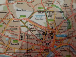
This page includes a scan of a non-free copyrighted map, and the copyright for it is most likely held by the company or person that produced the map. It is believed that the use of a limited number of web-resolution scans qualifies as fair use under United States copyright law, where this web page is hosted, as such display does not significantly impede the right of the copyright holder to sell the copyrighted material, is not being used to generate profit in this context, and presents information that cannot be exhibited otherwise.
If the copyright holder considers this is an infringement of their rights, please contact the Site Management Team to discuss further steps.

SABRE - The Society for All British and Irish Road Enthusiasts
Discuss - Digest - Discover - Help