A833
| A833 | ||||
| Location Map ( geo) | ||||
| ||||
| From: | Milton (NH489303) | |||
| To: | Balchraggan (NH527440) | |||
| Distance: | 9.3 miles (15 km) | |||
| Meets: | A831, A862 | |||
| Former Number(s): | B854 | |||
| Highway Authorities | ||||
| Traditional Counties | ||||
| Route outline (key) | ||||
| ||||
For the original A833 from Muir of Ord to Cromarty, see A833 (Black Isle).
Route
The A833 is a useful little bypass of Inverness for those travelling from Lochaber northwards. It is never a fast road, and not really that much shorter than passing through Inverness itself, but at least you avoid the city traffic!
It starts about a mile out of Drumnadrochit on the A831 and immediately switches back, passing through a rock cutting and climbing steeply up the hill around a series of narrow bends. The hill is known locally as the Culnakirk, after the farm near the top, and when it is occasionally pressed into use as a diversion for A82 traffic, it is a major bottleneck as lorries crawl slowly up, ever wary of oncoming traffic. A single bend was realigned and widened in c2014, although the reason behind the work is uncertain. Eventually, after a climb of over 200m in little over a mile, the road widens as it emerges onto open moorland. While this undulating summit stretch offers some good straights, there are a couple of tight bends to catch out the unwary, and then the road plunges down into the tight wooded valley carved out by the Allt Dearg. Although the road is wide enough, the bends are unexpectedly sharp and need to be negotiated with care.
After a couple more tricky bends, the narrow valley opens out a little as Glen Convinth, and the road starts its long, gentle descent. The river is re-crossed at White Bridge, after which there is a short climb past Ardendrain, beyond which comes the long straight, tree lined descent to Kiltarlity. This hill is not desperately wide, and steep enough for cars to rapidly gain speed while coasting in places. A couple of undulations help keep the speed in check, however, and the sudden emergence of a vehicle form a concealed entrance keeps drivers on their toes! At the bottom of the hill, the road emerges into open farmland, and sweeps round some fast bends to the Brockies Lodge. The junction in front of the Inn leads to the centre of the scattered Kiltarlity village, and is sometimes known as Brockies Corner. Off to the right is the Belladrum Estate, home of the eponymous music festival, one of the biggest events of its kind in the Highlands.
The road changes character again for the last couple of miles, running between high stone estate walls in a series of short straights punctuated by sharp bends. The route finally comes to an end at the junction with the A862 (former A9) about a mile short of Beauly, also confusingly known as Brockies Corner. For the rest of the 'bypass' route, turn left, pass through Beauly and then take the B9169 from the edge of Muir of Ord, which cuts across to the A9.
History
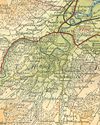
Whilst the original A833 was renumbered as part of the A832 in 1935, it would appear that the number wasn't re-used immediately. A 1936 Bartholomews map (left), and the 1936 OS Ten Mile Map both still show this route as the B854, even though all of the other roads in the area (including the A88 to A9) have been changed. The most logical explanation is that the road was not considered fit to be an A road until some improvements had been made, but this is only conjecture. Curiously, the 1937 Ten Mile map shows it as A833 but the 1939 and 1944 editions show both numbers. By 1946 it is unambiguously shown as A833 again.
The junction with A831 has been realigned to remove a very sharp angle and perhaps to reduce the initial gradient. Maps from the 1960s show most of the higher part of the route as single track, but widening seems to have been mostly on line as aside from a couple of Laybys, there is very little visible evidence of any improvements to the route south of Kiltarlity. Near Kiltarlity, a mile or so has clearly been upgraded, with widening and some realignment: at the first turning for Belladrum, near Tomnacross, an old loop can be traced past the houses, now used in part by the Belladrum Road and part as access to a house, and then there is a layby on the west side of the road about half way to the Brockies Lodge. There is also some evidence that the road used to kink slightly to the east immediately to the north of the Brockies junction, but after that it reverts to its former width and is hemmed in by old stone walls until meeting A862.
| A833 | ||
| ||
| ||
|


