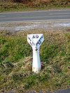
A9/Stirling - Perth
| A9 | |||||||||||||
| Location Map ( geo) | |||||||||||||
| |||||||||||||
| From: | Causewayhead, Stirling (NS803955) | ||||||||||||
| To: | Perth (NO085248) | ||||||||||||
| Via: | Dunblane, Auchterarder | ||||||||||||
| Distance: | 33 miles (53.1 km) | ||||||||||||
| Meets: | A907, M9, A820, A822, A823, A824, M90, A93, A85 | ||||||||||||
| Old route now: | B8033, B824 | ||||||||||||
| Highway Authorities | |||||||||||||
Transport Scotland • Stirling | |||||||||||||
| Counties | |||||||||||||
Stirlingshire • Perthshire | |||||||||||||
| Route outline (key) | |||||||||||||
| |||||||||||||
Causewayhead is the historic start point of the old Military road from Stirling Castle west to Inveraray and Fort William, a route that is initially followed by the A84 and A85 today. The first few miles to Keir Roundabout are still the traditional A9 route, but from there to Perth, the whole route has been upgraded to dual carriageway, and much of it is offline leaving the B8033 to pass through Dunblane and the A824 through Auchterarder.
The A9 from Dunblane to Perth is a new build dating from the late 70s up to the early 90s. It is the first section of the route to be a Primary, Trunk route, and also marks the start of the main dualled sections. The road starts at the Keir Roundabout at the northern end of the M9 and bypasses Dunblane to the west. The old route still passes through the town, partially dualled and classed as the B8033. This then leads back to the A9, where the sliproads to the southbound carriageway are on the old road line, whcih can be seen continuing in the field beyond for a short distance. The A9 is then an online upgrade until Greenloaning where it deviates again.
The long straight up to Greenloaning follows the line of an old military road (given its straightness) and ends with a kink as the A824 slip leaves, the A9 making a very short bypass of its old route through the village. There are plenty of at grade junctions leading to farms and private houses before and after Greenloaning, not least at the far end of this bypass. The fork junction into Greenloaning marks the old road which is briefly the A822, before turning to the right and leading back to the A9. Parts of the old A9 may survive as access roads to the north, but it is not until the B8081 is reached at Blackford that the old and new roads separate again. The A9 bypasses the village to the south, with a full access at-grade junction at the western end, and an eastbound on-slip only to the east.
After Blackford the A9 turns north at the grade-separated Gleneagles junction with the A823 station at a grade separated junction. A couple of kinks have been ironed out as the road passes between the Station and the golf course, before the A9 forks right at the at-grade fork with the A824. This is the start of the Auchterarder Bypass, where the A824 has been rerouted to follow the old A9 route through the town, and Aberuthven beyond. The A824 rejoins the A9 at another at-grade fork to the east.
The next section of the A9 follows the Strathearn Valley but has to climb out to the north before the land makes it too tough to reach Perth. Both the old and newroutes cross the River Earn on their respective bridges at Dalreoch and head up the "Cairnie Braes" with a 10% gradient heading south. The old road takes a series of bends before the bridge, and then up the hill to reach to the new line at the top at the B934 at Upper Cairnie. The new road has had a somewhat steadier climb, with only minimal earthworks to ease progress.
The B934 meets at another at-grade junction, and we're onto the last few miles to Perth. The new road takes a long sweeping bend around Crossgates, where the old route is now an unclassified road through trees, looping back on to the A9. Old maps suggest a similar, but shorter, realignment has occurred a mile or so further on, but there is little evidence on the ground. The old A9 then remains in use until the Broxden Roundabout. Here, the A9 turns left and bypasses Perth while the old road becomes the A93 into the city. Average speed cameras were installed on the route in 2014 to try and reduce the high speeds to protect the right turn junctions on the road.
History
| Dunblane Bypass | 10th December 1990 |
| Dunblane to Greenloaning | October 1968 |
| Greenloaning Diversion | January 1969 (Approx) |
| Greenloaning to Blackford | 14th December 1992 |
| Blackford Bypass | 7th December 1980 |
| Loaninghead Junction | November 1975 |
| Gleneagles Station Crossroads | January 1972 (approx) |
| Auchterarder & Abruthven Bypass | 21st October 1983 |
| Cairnie Braes | October 1986 |
| Burnside to Broxden | July 1983 |
| Perth Western Bypass | 17th September 1985 |
Links
legislation.gov.uk
- The M9/A9 Trunk Road (Gleneagles Station to Auchterarder) (Redetermination of Means of Exercise of Public Right of Passage) Order 2017 - This order changes use of a section of the old road into foot and cycle path.


