A965
| A965 | ||||
| Location Map ( geo) | ||||
| ||||
| From: | Kirkwall (HY449112) | |||
| To: | Stromness (HY253081) | |||
| Via: | Maes Howe | |||
| Distance: | 15.8 miles (25.4 km) | |||
| Meets: | A963, B9054, A966, A986, B9055, A964, A967 | |||
| Highway Authorities | ||||
| Traditional Counties | ||||
| Route outline (key) | ||||
| ||||
The A965 links the two primary towns in Orkney, Kirkwall and Stromness. It was formerly the most important route on Orkney as the majority of vehicular traffic for Orkney arrives at Stromness from the Scrabster Ferry, However in recent years the Pentland Ferry service has moved a significant amount of traffic to the A961. Despite this, the A965 is still by far the busiest route on the islands outside Kirkwall.
Route
The A965 starts out by heading west along Ayre Road from the Kiln Corner Roundabout with the A963 (Junction Road) and A960 (Harbour Street) close by the Kirkwall waterfront. It then crosses another roundabout and head out towards the Hatston Industrial Estate, which is accessed from the Ayre Mills Roundabout, the penultimate on the route. This roundabout also meets the A963 spur, Pickaquoy Road, which is now signed for through traffic as the town centre relief road. The A965 continues west, bypassing the Industrial Estate (although the original route went straight through), which is also where the pier for the Aberdeen – Kirkwall – Lerwick ferry can be accessed. After passing the summit of the route at 43m, the road drops towards the coast and there are fine views out across the low lying northern isles, showing as thin green strips on the horizon.
There are several sites of interest for tourists along the route, including a number of chambered cairns and Souterrains, as well as some other, more modern attractions. After a couple of miles of curving through fields, the road comes right down to the shoreline of the Bay of Firth, with an increasing number of roadside properties as the village of Finstown is approached. Finstown marks the point where the A965 leaves the coast behind and heads across the interior of the mainland for the south coast, and it's also here that the A966 turns right to follow the north coast. The road climbs a little across the lower slopes of the Hill of Heddle as it leaves the village, and then meets the A986 leaves similarly about a mile further on, as it too heads north across the island. The A965 soon turns to the south west, enjoying a series of straights as it passes Maes Howe, a 5000-year-old chambered cairn with Viking graffitti which is one of the star attractions on Orkney.
Beyond Maes Howe, the B9055 turns right to follow the narrow strip of land between the Loch of Stenness and the Loch of Harray. This road leads to the spectacular settings of the famous Stones of Stenness and Ring of Brodgar, and on to the famous prehistoric settlement of Skara Brae, all of which form part of the World Heritage Site. The small village of Stenness, then lies strung along the southern shore of the loch, before the A964 joins having taken the longer coastal route from Kikrwall. Just after the junction, the Bridge of Waithe carries the road over the short channel that makes the Loch of Stenness ever so slightly tidal. A series of sweeping bends then lead the road around the low hill at Deepdale and on to meet the A967, which again heads north.
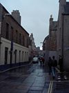
Stromness is slowly growing north to meet the A967, and so after a short street the road enters the town. Until c2007, the A965 continued straight down North End Road. However, it now kinks left to the new roundabout and follows Ferry Road along the waterfront, and past the harbour where the Northlink ferry from Scrabster docks. Ferry Road becomes steadily narrower, before finally dog-legging inland at a small square to find Victoria Street, the historic main street through the town. The A965 continues south through the town, along a narrow slabbed and cobbled street (which is not one way), often crowded with badly parked cars and pedestrians. It is very picturesque, has a ban on buses, a 3 ton weight limit and 15mph speed limit but despite all of this it is not really designed for the automobile, certainly not the two way traffic which tries to use it! Victoria Street becomes Dundas Street, which winds round a nasty double bend onto Alfred Street before the route ends on the southern edge of Stromness, with Whitehouse Lane looping back round the town, but hardly any more suited to traffic.
History
The A965 still largely follows the same route it was assigned in 1922. However, there have been a couple of minor changes to the route, and one more significant one. The current unclassified route through the industrial estate and past the ferry terminal at Kirkwall is the original line of the A965. It was diverted onto its current route further south during the war when an airfield was built on the original route, the remnants of which survive alongside the industrial estate road. Further west, the road has been realigned closer to the shore at Grimbister, the old road line partly retained as a picnic site. The only other change is the more recent re-routing along Ferry Road in Stromness as noted above.


