A979
| A979 | ||||
| Location Map ( geo) | ||||
| ||||
| From: | Oyne (NJ691257) | |||
| To: | Gartly (NJ521315) | |||
| Distance: | 13 miles (20.9 km) | |||
| Met: | A96, B992, A97 | |||
| Now part of: | B9002 | |||
| Traditional Counties | ||||
| Route outline (key) | ||||
| ||||
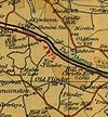
The A979 was a medium-length A-road in west Aberdeenshire. Linking the A96 and A97 it followed the Aberdeen to Inverness railway line for its entire length.

The road started on the A96 to the east of Oyne in Garioch. It headed west, going under the railway almost immediately before passing through Oyne itself. After about the same distance again the road zigzagged over the railway line before descending gently into Insch, the largest settlement on the road. The B992 came in from the right and the village centre by the station and then there was a short multiplex across a level crossing back into open fields.
After the end of the multiplex the terrain became more hilly, with the road, railway line and a small stream wedged into a narrow, steep-sided valley. This started to widen out after a couple of miles after which the road passed the Ardmore Distillery to reach Kennethmont. A right-hand bend on the far side of the village led to another bridge over the railway line, then the road skirted the Leith Hall estate (now owned by the National Trust for Scotland). A mile or so of road adjacent to the railway line led to another bridge over the line and the adjacent Water of Bogie. A couple more bends took the road to its terminus on the A97 just to the south of Gartly.
History
Although the route of the A979 was not deemed worthy of a number when roads were first classified in 1922, it was classified in the late 1920s. The route then lasted for over 40 years before being downgraded and renumbered as part of the B9002 in 1973 or 1974, despite this creating a lengthy multiplex between the B9002 and A97. The only evidence of any notable improvements along the route are at Glanderstone, around 3 miles west of Insch, where the road formerly kinked to the south through the farm yard.
The western end of the former A979 is in part on the line of the Old Military Road built by Major Caulfeild in the 1760s from Stonehaven through Alford and Huntly and on to Portsoy. Although the original line of the military road may have been partially used for the construction of the railway line, the section north of Kennethmont and along the east bank of the Water of Bogie is essentially the course of the military road.
| A979 | ||
| ||
| ||
|

