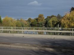
Albany Bridge
| Albany Bridge | |||
| Location Map ( geo) | |||
 | |||
| |||
| Location | |||
| Between Esher and Hersham | |||
| County | |||
| Surrey | |||
| Highway Authority | |||
| Surrey | |||
| On road(s) | |||
| A244 | |||
| Crossings related to the A244 | |||
The Albany Bridge carries the A244 across the River Mole. It is situated on the A244, just west of the roundabout at Princess Alice Hospice in SW Esher. Connecting Esher and Hersham, it was named after the Duchess of Albany who lived at Claremont House on the Portsmouth Road (the current A307 and the former A3). It was originally an ornamental timber bridge built in the mid-19th century. That structure was replaced by a stone bridge in 1907. That bridge was replaced by a concrete bridge that was put in place in 1965/6, when this particular section of the 244 was dualled.
This report from Surrey County Council, published in 2007, details a number of the problems that there have been with the current structure in recent years. Primarily, the bridge just isn't strong enough to take fully laden trucks. As a consequence, there has been substantial work undertaken to try and rectify the situation, the latest of which took place between November 2013 and March 2014. In addition, the heavy rainfall and consequent flooding on the Mole in the winter of 2013/14 also caused a need for additional repairs.
History
This historical commentary from "The Elmbridge Hundred'' may also be of interest.
"The name Amelebrige derives from the original name of the River Mole (‘Amele’) and the Old English word for a bridge (‘brige’). The Mole runs pretty much through the centre of Elmbridge, from north-east to south-west, cutting the Borough in two.
Local historians have enjoyed speculating where this elusive bridge over the River Mole may have been situated, and whether a settlement of some kind lay alongside. The Victoria History of Surrey (1911) claims that the bridge must have been located at the juncture where ‘the road from London to Chertsey crosses the Mole or Emlyn on its way west, and here probably the hundred court was held’. By process of elimination, eminent local historian Royston Pike posited that this place must have been on the lower slopes of Esher, at the bottom of what is now Lammas Lane. This would site the bridge where Albany Bridge now stands, just by the Princess Alice Hospice. Pike’s other reason for suggesting the site is that ‘Albany Bridge … is almost exactly in the middle of the Hundred, which would make it very convenient for access from all parts.’ The speculation is a logical one, but no conclusive proof has been forthcoming as yet - ‘the ‘sullen Mole’, as Milton calls it, keeps its secrets’ (Pike, The Elmbridge Story, 1977).
Nevertheless, what is certain is that the name ‘Elmbridge’ has nothing to do with elm trees. Pike writes in no uncertain terms that: ‘The inclusion in the new Borough’s armorial bearings of a lusty elm growing out of a two-arched bridge is just a piece of heraldic nonsense.’"
| Albany Bridge | ||
| ||
|
