Star.pngStar.pngStar.pngStar grey.pngStar grey.png

Alhambra Roundabout

From Roader's Digest: The SABRE Wiki
Jump to navigation Jump to search
Alhambra Roundabout
Location Map ( geo)
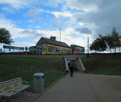
Alhambra Roundabout pedestrian underpass leading to Doncaster Road, Barnsley - Geograph - 2610135.jpg
Pedestrian underpass from the centre of the roundabout
Cameraicon.png View gallery (1)
Location
Barnsley
County
Yorkshire
Highway Authority
National Highways
Junction Type
Roundabout
Roads Joined
A61, A628
Junctions related to the A628

Alhambra Roundabout is a junction of the A61 and the A628 at the south end of Barnsley Eastern Relief Road. It opened in 1975 along with the Eastern Relief Road.

The A61 runs from Derby to Thirsk (Yorkshire) via Sheffield and Leeds. The A628 runs from Hollingworth to Pontefract

Routes

Route To Notes

A61

Wakefield, Pontefract (A628), Huddersfield (A635)

A61

Sheffield, Doncaster (A635), Rotherham (A633)

A628

Manchester, Sheffield, (M1)


Alhambra Roundabout
Related Pictures
View gallery (1)
Alhambra Roundabout pedestrian underpass leading to Doncaster Road, Barnsley - Geograph - 2610135.jpg
Other nearby junctions
Barnsley
Junctions on the A61
Pentagon Island • Mansfield Rd Rdbt • Little Eaton Rdbt • Watchorn Roundabout • Wingfield Rd • Clay Cross • Brimington Rdbt • Meadowhead • Lowfield • Granville Sq
Sheffield IRR: 1 Cutlers Gate • 2 Park Sq • 3 Granville Sq • 4 Bramall Ln • 5 Moore St • 6 University Sq • 7 Shalesmoor • 8 Corporation St • 9 Bridgehouses • 10 Savile St
Shalesmoor • Tankersley • Birdwell • Alhambra Rdbt • Athersley South Fork • Sandal Fork • Stourton • Tunstall • Hunslet Int • Hunslet • Woodpecker • Sheepscar • Moortown Rdbt • Harewood • Otley Rd • Spacey Houses Rdbt • Prince of Wales Rdbt • New Park • Ripon Bypass Rdbt • Baldersby • Busby Stoop Rdbt • South Kilvington


SABRE - The Society for All British and Irish Road Enthusiasts
Discuss - Digest - Discover - Help