B2139
| B2139 | ||||||||||
| Location Map ( geo) | ||||||||||
| ||||||||||
| From: | Coolham (TQ120227) | |||||||||
| To: | Whiteways Lodge (TQ002107) | |||||||||
| Via: | Storrington | |||||||||
| Distance: | 12.3 miles (19.8 km) | |||||||||
| Meets: | A272, B2133, A283, A284, A29 | |||||||||
| Highway Authorities | ||||||||||
| Traditional Counties | ||||||||||
| Route outline (key) | ||||||||||
| ||||||||||
The B2139 is a route running generally north-east to south-west and serving the Sussex villages of Thakeham, Storrington, and Amberley.
Coolham – Storrington
The road starts at a junction with the A272 at Coolham where Coolham Road becomes classified. Somewhat strangely Coolham Road has priority over the much more important A272. It heads almost directly south, meeting the B2133 at a staggered crossroads where the B2139 has priority. It then winds into the hamlet of Thakeham and makes a lot of fuss, including a 20 mph limit for what is a pretty small settlement.
The road then continues straight on its way to Storrington. There is a right turn at a mini-roundabout outside the local school before it heads south-westerly through Sullington, passing a speed camera, to another mini-roundabout, this time with the A283.
A multiplex with the A283 down Storrington High Street leads to yet another mini-roundabout, where our route forks off leftward. (Of course, the one place on this route that could really have done with a mini-roundabout, i.e. the start at the A272, didn't have one.)
All of this section of the road was originally unclassified and only became part of the B2139 in 1935.
Storrington – Whiteways Lodge
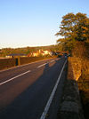
The original 1922 northern end of the B2139 was on the A283 in Storrington. The road promptly heads out of town continuing to head south-west before running at the foot of the South Downs, which are particularly steep here and so the road doesn't cross them. The B2139 then reaches Amberley and zigzags to go past the Chalk Pit Museum and under the Arun Valley Railway before crossing the River Arun on the Houghton Bridge. The bridge has no provision for pedestrians other than a few refuges, and despite being marked as two lanes is still quite narrow. Work appears to have taken place recently, though, to help widen part of it. The B2139 then runs parallel to the river through Houghton before heading up to the Whiteways Lodge Roundabout, where it meets the A29 and A284 and also terminates.


