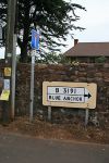
B3191
| B3191 | ||||
| Location Map ( geo) | ||||
| ||||
| From: | Williton (ST077411) | |||
| To: | Carhampton (ST011425) | |||
| Via: | Watchet, Blue Anchor | |||
| Distance: | 6.4 miles (10.3 km) | |||
| Meets: | A39, B3190, A39 | |||
| Former Number(s): | B3189, B3190 | |||
| Highway Authorities | ||||
| Traditional Counties | ||||
| Route outline (key) | ||||
| ||||
The B3191 is one of the shorter B-roads in West Somerset, basically running along the coast parallel to the A39 to serve the town and old port of Watchet.
We start at a T-junction in Williton, where the A39 turns ninety degrees to head south down Fore Street. The B3191 heads north, surprisingly up North Street. We then get priority at the fork, going left into North Road and so past Danesfield Secondary School and out into the countryside. However, it doesn't last long as soon we are running between the houses of Five Bells.
We then reach a T-junction on the B3190 and turn right. The number of this next section of road is debatable. Prior to 1935 the Williton to Five Bells road was the B3189 and so the Five Bells to Watchet road was incontrovertibly the B3190. However, with the extension of the B3191 eastwards to Williton it would make sense for the middle section of road to take that number as well. The fingerpost at the Five Bells junction states the road into Watchet is the B3190 but the modern sign by the railway bridge in Watchet claims the same road is B3191. Maps are non-committal, giving either number or none.
The road, whatever its number, heads north through St Decumans, with the parish church standing proud on the hill to the left. The road now drops down into Watchet proper, with the sprawling mass of the paper mill off to the left. Another TOTSO, with the unclassified road ahead leading to Doniford, sees us turning left over the railway bridge and then swinging right , briefly alongside the West Somerset Railway and then left into the town centre. Swain Street is the main shopping street, and it is narrow with some parked cars; it leads to the harbour. From the harbour, we're definitely on the B3191; this is the road's original eastern end where it met end-on with the B3190.
When the road turns sharp left into Market Street and past the museum, a glimpse of the marina in the old harbour can be had to the right. It is well worth stopping and exploring if you have time. Well, you have, otherwise you'd be on the A39! The road continues, westwards now, with houses along both sides. It is hard to believe that those on the right back straight onto the sea wall. Soon houses give way to caravan parks, and the road starts to climb up the hill.
A few bends take us in land, then more caravan parks, scattered between open fields, and we drop back down to the shore at Blue Anchor. Here the road runs right along the shore, with plenty of parking (you will probably need to stop to see over the sea wall) and often an ice cream van through the summer months. After about half a mile, we swing inland, crossing the WSR at a level crossing. To the right, are old railway carriages converted to 'camping coaches', and preserving a near-century-old tradition. It is now just a short run, along a twisty hedge-lined lane to Carhampton and the A39 once more. Looking at the map/aerial photography, you have to wonder if the road once ran through the churchyard (the B3191 never did), making a much straighter route to the westbound A39.
Coastal erosion
A section of the B3191 immediately to the west of Watchet, climbing up Cleeve Hill, has long been of concern due to the stability of the underlying geology. In August 2022, various works were carried out including the installation of new monitoring equipment and gates for closing the road in the event of any concerns. These first came in to use when Cleeve Hill was closed in January 2023. A routine geotechnical survey had suggested that there was 'significant movement' in the already partially slumped coastal slope below the road, and that further collapse was potentially imminent.
Historically, it appears that this particular part of the coast is particularly prone to erosion, perhaps due to a weak zone in the geology. Comparison of old maps suggests that the road has been moved inland by approx. 10m at some time in the 150 years, leading to the slight wiggle to the east of Daws Castle. In the same time period, the coast has eroded back by 20-30m, leading to the current (2023) position where the road is right at the top of the slope, and at serious risk from any further erosion.


