B3266
| B3266 | ||||||||||
| Location Map ( geo) | ||||||||||
| ||||||||||
| From: | Boscastle (SX098906) | |||||||||
| To: | Mount Charles (SX041689) | |||||||||
| Via: | Camelford | |||||||||
| Distance: | 15.9 miles (25.6 km) | |||||||||
| Meets: | B3263, B3314, A39, A389 | |||||||||
| Former Number(s): | B3264, B3265 | |||||||||
| Highway Authorities | ||||||||||
| Traditional Counties | ||||||||||
| Route outline (key) | ||||||||||
| ||||||||||
Route
The B3266 is a mostly rural Class II road in North Cornwall. It offers a significantly faster and shorter route than the A-road alternative between Camelford and Bodmin.
Boscastle – Mount Charles
The B3266 starts in the part of Boscastle known as Paradise. This is the newer part of the village and was away from the area devastated in the 2004 floods. The road starts from a junction on a bend of the B3263 as that road begins its descent to the harbour. Leaving the village, the B3266 climbs moderately as it follows the deep Jordan Valley.
There are two significant bends: a left turn on crossing the stream and then right at a disused quarry. The bends exist to avoid the worst of the natural contours in these parts. The climb is continued for the next couple of miles and the road nears a height of over 250 metres. On higher ground still, the road is relatively straight and significant progress can be made.
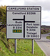
It is essentially farmland all the way until the first junction with another classified road. This is the near-crossroads for the B3314. The junction is called Camelford Station after the now-disused former station of the North Cornwall Railway that was located very near the junction.
The road now descends gently towards the back of Camelford, and passes an industrial estate and a sports centre. A 30 mph limit stops the rapid progress. A spur of the B3266 (formerly B3265) is on the left and goes into the town centre. The main route continues around the back of town. It bends to the south round a new housing estate and follows a new alignment to meet the A39. In this way the B3266, together with the B3314, makes an unofficial bypass of Camelford. Turning right, a short multiplex with the A39 is necessary. There is a popular garage and filling station at this point.
Turning left off the A39, the road branches away in a southwesterly heading again. A newish 50 mph speed limit has been imposed. The road is quite rural so the limit is on safety grounds. However, the road does have good sight lines, long straight sections and plenty of overtaking opportunities. There are only a couple of sharper bends and no junctions of note. There is one small village of Longstone which has a 30 mph limit, although the road bypasses a few more villages.
The road ends at a T-junction with the busy A389. Turn left to continue to Bodmin.
History
Prior to 1935 the B3266 only consisted of the section south of the A39. The road between Boscastle and Camelford was the B3264.
The junction with the A39 was formerly near a bend giving limited visibility. Upon development of a housing estate in Camelford, the opportunity was taken to divert the road to the east somewhat and away from the bend. This has definitely improved sightlines. This has also slightly extended the A39 multiplex.


