B4226
| B4226 | ||||
| Location Map ( geo) | ||||
| ||||
| From: | Cinderford (SO662131) | |||
| To: | Coleford (SO580112) | |||
| Via: | Forest of Dean | |||
| Distance: | 5.6 miles (9 km) | |||
| Meets: | A4151, B4227, B4234, B4432, B4028 | |||
| Highway Authorities | ||||
| Traditional Counties | ||||
| Route outline (key) | ||||
| ||||
For the original B4226 east of Cinderford in the Forest of Dean, see B4226 (Cinderford - Elton).
The B4226 crosses the Forest of Dean. The road was originally unclassified, but it gained its present number in 1935 when it became available upon the creation of the A4151.
The road starts on the A4151 on the edge of Cinderford. This is effectively a T-junction on a big bend. Most traffic will be approaching the B4226 from Littledean, and while the A4151 bends around to the right, the B4226 is accessed by driving more or less straight on up the steep hill. There are in fact two end points to this road, located just under a quarter of a mile apart. The two spurs used to meet at a T-junction where the branch from Littledean took priority, but this has recently been converted into a roundabout. Presumably the angle of the junction at the end of the branch towards Littledean is sufficiently sharp that another junction in the direction of Cinderford town centre is needed.
The two spurs meet at the highest point in Cinderford, from which it is possible to look across the Severn estuary. Leaving the roundabout to the west, we make the long descent down St White's Road, which runs along the southern edge of town before skirting the northern edge of Ruspidge. Just after St White's primary school, the former B4227 exits to the left, in the direction of Soudley and the Dean Heritage Centre. A road to the right will take you back towards the centre of Cinderford. As we approach the bottom of the hill, the sole remaining part of the B4227 departs on the right just before we cross Cinderford Brook; it takes you across Cinderford's sprawling industrial estate. Leaving the town behind, we climb into the heart of the Forest of Dean. There are a few clearings on this stretch, one of which unexpectedly contains the Dilke Memorial Hospital, but essentially the road remains thickly wooded for a few miles.
Lesson
The B4226 takes us past a cluster of Forest of Dean tourist destinations. First, we pass the Speech House Hotel to the left, a grand Victorian building that looks quite out of place on its own among the trees. There is also an unclassified road that begins by the hotel, providing a nice drive towards New Fancy, which is a nice place for an afternoon walk. If we continue on the B4226, it is not long before we also pass Beechenhurst Lodge, which offers parking, toilets, a picnic site, and usually food and refreshments during the summer season. It is also the best place from which to visit the Forest of Dean Sculpture Trail. This is a mapped walk through the woods in search of various pieces of modern art that have been constructed among the trees.
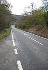
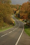
Between Speech House and Beechenhurst Lodge, the road dips and turns sharply to the right and sharply to left. This is an extremely scenic stretch of road, particularly during the winter when, in addition to the magical appearance of the snow on the trees. However, it can also perilous in ice and snow, and it is not unusual to see collections of cars abandoned there during the winter, having either failed to make it up the hill or after losing control heading down it.
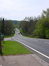
If we survive the bends, the road then takes in a long straight down the hill towards Cannop Brook. Here we meet that great survivor of Forest of Dean B-roads, the B4234. This crosses over, ceding priority to our route, by the Pygmy Pinetum garden centre. It follows Cannop Brook closely, offering several more opportunities to walk among the trees or find a pleasant spot for a picnic.
The B4226 then begins the long climb towards Broadwell. We pass the Hopewell Colliery mining museum, which reminds us of the historical importance of the mining industry to the local economy. When we arrive in Broadwell, the trees run right up to the edge of the settlement, and it is not uncommon to see the odd house or cluster of houses dotted among them. The B4432 turns right here, and there's an unclassified road to the left that serves as a bypass for local traffic wishing to avoid Coleford; it eventually leads to the B4228, which heads south towards Chepstow.
After Broadwell, there is a short section of road passing through open fields before we descend into Coleford. The B4226 never makes it into the town centre; it ends at a T-junction on the B4028 to the northeast of the town centre.


