B4297
| B4297 | |||||||||||||||||||||||||
| Location Map ( geo) | |||||||||||||||||||||||||
| |||||||||||||||||||||||||
| From: | Court Henry(S) (SN556219) | ||||||||||||||||||||||||
| To: | Yspitty roundabout (SS555982) | ||||||||||||||||||||||||
| Via: | Maesybont, Capel Hendre, Fforest, Llangennech, Bynea | ||||||||||||||||||||||||
| Distance: | 20.9 miles (33.6 km) | ||||||||||||||||||||||||
| Meets: | A40, B4300, A476, B4556, A483, A48, A4138, B4303, A4138, A484 | ||||||||||||||||||||||||
| Former Number(s): | A4138, A48 | ||||||||||||||||||||||||
| Primary Destinations | |||||||||||||||||||||||||
| Highway Authorities | |||||||||||||||||||||||||
| Traditional Counties | |||||||||||||||||||||||||
| Route outline (key) | |||||||||||||||||||||||||
| |||||||||||||||||||||||||
For the original B4297, now part of the A4067, see B4297 (Ystalyfera - Sennybridge).
Route
The B4297 is a zigzagging B-road in east Carmarthenshire.
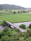
The road starts on the A40 to the south of Court Henry and heads south along a straight road. It descends into Dryslwyn and goes around the bottom of the castle mound before crossing the River Towy. We now continue along the valley bottom, with Paxton's Tower visible on the ridge ahead, to reach a T-junction on the B4300. There's a multiplex along that road to the left.
The B4297 quickly regains its number by bearing right and climbs out of the valley, with a hairpin bend to the right at one point. On reaching the top it continues south across the fields and passes through a couple of scattered settlements before reaching Gorslas and the A476, which is crossed at a staggered crossroads. The road is now mostly built-up for the next few miles as it descends through Penygroes and Capel Hendre. In the latter it TOTSOs right and, a few fields later, reaches the A483.
There's another short multiplex to the right before that road continues ahead towards the M4 and we bear off to the left. Again we follow an undulating route across fields and pass through a few scattered settlements. Presently the road reaches the valley of the River Loughor and runs halfway up the valley side to reach Fforest and the A48. There's now a multiplex to the left to a mini-roundabout where we turn right onto the A4138. After going through Hendy and crossing the M4 at J48 the road reenters open country. The B4297 regains its number by turning left at traffic lights.
We follow Pontarddulais Road into Llangennech then climb into Bryn and descend again to reach the outskirts of Llanelli; there are only brief sections of open land between these settlements. We run through the suburb of Pemberton along Gelli Road to reach traffic lights. To the right a short spur of the B4297 takes us back to the A4138 but the mainline of the road turns left, almost doubling back on itself.
We continue southeast with ribbon development meaning that little open country is visible. Presently we go over the railway line above Bynea station and then continue through an industrial estate into Yspitty. The road ends at a roundabout on the A484 on the bank of the Loughor Estuary.
History
Originally the road from Greynor to Hendy was part of the B4301, the road from Hendy to Pemberton was numbered B4302 and the section from there to Yspitty was the mainline of the A48. The remainder was unclassified. These two B-roads were quickly upgraded to become part of the A4138.
The B4297 first came into being in 1935 covering that part of the road's present route not described in the paragraph above. At the same time the ex-B4301 was renumbered as part of the A483 but the western section of the A4138 was unchanged.
Following construction of the M4 in 1977 many of the A-roads in this area were upgraded to serve the new motorway better. The B4297 was therefore extended south on three separate occasions following road upgrades; it served Hendy by 1985, Pemberton by 1991 and Yspitty by 1994, giving the road its present route.


