B4410
| B4410 | ||||||||||
| Location Map ( geo) | ||||||||||
| ||||||||||
| From: | Tan-y-bwlch (SH659409) | |||||||||
| To: | Prenteg (SH588416) | |||||||||
| Via: | Garreg | |||||||||
| Distance: | 5.4 miles (8.7 km) | |||||||||
| Meets: | A487, A4085, A498 | |||||||||
| Old route now: | A487 | |||||||||
| Primary Destinations | ||||||||||
| Highway Authorities | ||||||||||
| Traditional Counties | ||||||||||
| Route outline (key) | ||||||||||
| ||||||||||
The B4410 is a short rural B-road near Porthmadog in North Wales, which is split into two distinct sections.
Route
The route starts in front of a grand hotel on the A487 at Tan-y-bwlch in the Vale of Ffestiniog, not far from Maentwrog. The junction was originally a simple T junction, but the A487 has been realigned, leaving the old loop as part of the B4410, with a stone bus shelter making it look more like a bus layby than part of the route. It immediately curves to head northwest, climbing steeply through the woods and around some sharp corners to Llyn Mair, where it run along the northern shore of the small lake. The road is built up on a retaining wall for some of the length of the lake, meaning there are good views across the water, and a picnic site sits in the trees beyond. As it starts to climb again, the route goes past the drive to Tan-y-bwlch station on the Ffestiniog Railway before going under the line and finding a long straight, which continues to climb through the forest.
After crossing the summit of nearly 160m, the centre line disappears, and soon after the route emerges from the trees, finding itself in a narrow pass between two low but steep rocky hills. The high stone walls to either side seem to make the pass feel even narrower, with a rocky cliff rising up behind the wall to the right. gentle descent drops the road into the tiny village of Rhyd, the only settlement along this part of the route. The few houses are quickly passed, and then the road is climbing again up to a second summit, of 143m. At the top the road bends sharply to the right before beginning the winding descent. The centre line has reappeared, but the road still feels narrow. The lower it gets, however, the wider the road becomes, and towards the bottom there is some evidence that the bends have been eased, with remnants of the old road hidden in the trees to either side. At the end of a short straight, a long double bend brings the road out onto the Traeth Mawr, a vast area of flat land forming the valley floor of the Afon Glaslyn.
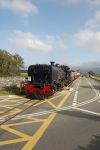
The tiny village of Garreg soon appears, where the B4410 crosses the A4085 at a staggered crossroads. The next section of the route is in complete contrast to the hilly first section, as the route continues west across the completely flat land. A couple of short straights bring it alongside the Welsh Highland Railway, and the two then run side by side for half a mile. At the end of the straight, the Pont Croesor bridge carries road and rail over the Afon Glaslyn, with the road turning sharp right over a level crossing on the western bank of the river. This leads to traffic queuing back across the bridge when a train is passing. Another short straight follows and then a left turn lifts the road up to meet the A498 at a sharp fork at the tiny settlement of Prenteg on the edge of the Traeth Mawr.
History
All of the above was unclassified in 1922. The B4410 originally ran from the A499 at Llanwnda near Caernarfon, south via Penygroes, then east to end on the A498 at Tremadog. The route was then extended via a lengthy multiplex along the A498 across the Traeth Mawr to Garreg; the western part of the current route. In 1937, the entire original section of the B4410 was upgraded to Class I status, becoming the A4085. A little later, but before 1939, the route was further extended east from Garreg to Tan-y-bwlch, thus giving the B4410 its current route.
In the 1960s the A487 and A4085 between Penrhyndeudraeth and Caernarfon swapped numbers, so the former took over the ex-B4410. Sections of this road, particularly near Caernarfon, have since been bypassed but the route remains essentially the same.


