Star.pngStar.pngStar grey.pngStar grey.pngStar grey.png

B4483

From Roader's Digest: The SABRE Wiki
Jump to navigation Jump to search
B4483
Location Map ( geo)
Cameraicon.png View gallery (4)
From:  Woodsetton (SO939927)
To:  Coseley (SO948944)
Distance:  1.3 miles (2.1 km)
Meets:  A457, A4123, B4163
Primary Destinations
Highway Authorities

Dudley

Traditional Counties

Staffordshire

Route outline (key)
B4483 Woodsetton - Coseley
Station Bridge, Coseley

The B4483 is an unremarkable urban B-road running through the town of Coseley between the area of Woodsetton, some 2 km northwest of Dudley town centre, and the area of Wallbrook, near to Dudley Metropolitan Borough's border with City of Wolverhampton Council.

It runs for some 450 m north-north-eastward from a junction with the A457 Sedgley Road before being briefly interrupted by the A4123 Wolverhampton - Birmingham New Road; there's a staggered crossroads here. Our road then passes The Green (where Coseley's War Memorial is), by-passes the main shopping precinct of Coseley (Castle Street in Roseville), and continues past Coseley Railway Station to end at a junction with the B4163 Harding Street in Coseley.

Owing to its short length the history of the B4483 is not fully known. The 1932 Ten-Mile Map suggests that the road had become part of the B4175 by the time of publication - but this could be a misinterpretation or mapping error. Certainly the road was in existence by the 1950s and the B4175 came no closer than Upper Gornal. A more certain mapping error occurred in the 1955 revision of the Ordnance Survey Six Inch map, where the road was labelled as the B4183 in a number of places along its course - clearly an error as it had been labelled correctly in both older and newer maps.

In the 1980s, the bridge carrying the B4483 over the railway was replaced with a new one closer to the station. This straightened the road, crossing the track diagonally rather than at a right-angle. The only remaining evidence of the old route is a secluded cul-de-sac service road that serves a few houses towards Clayton Park, as well as a wider section of pavement before the bridge opposite Havacre Lane, giving an indication of the direction of the previous road.

A little known fact is that Kelly Groucutt of the Electric Light Orchestra, was born on the Gough Road section of the B4483, in the house named 'Church View'. A blue plaque was unveiled on the front of the house in March 2015.


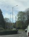
B4483
Places
Related Pictures
View gallery (4)
Main road (B4483) at station bridge, Coseley - Geograph - 1017741.jpgGough Road Bend - Geograph - 4307367.jpgB4483 in Coseley - Geograph - 1017736.jpgIMG 0309.JPG indo air 2 urbis axia 2.jpg
Other nearby roads
Wolverhampton
A41 • A446(M) • A449 • A454 • A457 • A459 • A460 • A462 • A463 • A464 • A464 (Oaken - Nantwich) • A4038 • A4039 • A4098 • A4123 • A4124 • A4126 • A4150 • A4444 • A4510 • B4155 • B4156 • B4157 • B4158 (Wolverhampton) • B4159 • B4160 (Wolverhampton) • B4161 • B4162 • B4162 (Monmore Green - Deepfields) • B4163 • B4164 (Moxley - Ocker Hill) • B4200 • B4454 (Wednesfield) • B4464 • B4484 • B4563 • B4590 • Bilston Link Motorway • C6 (Staffordshire) • C17 (Dudley) • C19 (Dudley) • C20 (Dudley) • C40 (Staffordshire) • C59 (Staffordshire) • C60 (Staffordshire) • C77 (Staffordshire) • C78 (Staffordshire) • C84 (Staffordshire) • C99 (Staffordshire) • C108 (Staffordshire) • C114 (Staffordshire) • C116 (Staffordshire) • C125 (Staffordshire) • C131 (Staffordshire) • C137 (Staffordshire) • C153 (Staffordshire) • C169 (Staffordshire) • C170 (Staffordshire) • C184 (Staffordshire) • C198 (Staffordshire) • C227 (Staffordshire) • C234 (Staffordshire) • C235 (Staffordshire) • C253 (Staffordshire) • C259 (Staffordshire) • C260 (Staffordshire) • C272 (Staffordshire) • C273 (Staffordshire) • C307 (Staffordshire) • C335 (Staffordshire) • C342 (Staffordshire) • C500 (Staffordshire) • E33 (London - Glasgow) • E34 (Old System) • Holyhead Road • M6 • M6 Toll • M54 • NCN81 • Northern and Western Motorway • T11 (Britain) • T14 (Britain) • T49 (Britain) • T50 (Britain) • U99 (Wolverhampton) • U110 (Wolverhampton) • U111 (Wolverhampton) • U112 (Wolverhampton) • U113 (Wolverhampton) • U114 (Wolverhampton) • U115 (Wolverhampton) • U116 (Wolverhampton) • U117 (Wolverhampton) • U118 (Wolverhampton) • U119 (Wolverhampton) • U120 (Wolverhampton) • U121 (Wolverhampton) • Western Orbital • Wolverhampton Outer Ring Road
Dudley
Coseley
B4400 – B4499
B4400 • B4401 • B4402 • B4403 • B4404 • B4405 • B4406 • B4407 • B4408 • B4409 • B4410 • B4411 • B4412 • B4413 • B4414 • B4415 • B4416 • B4417 • B4418 • B4419
B4420 • B4421 • B4422 • B4423 • B4424 • B4425 • B4426 • B4427 • B4428 • B4429 • B4430 • B4431 • B4432 • B4433 • B4434 • B4435 • B4436 • B4437 • B4438 • B4439
B4440 • B4441 • B4442 • B4443 • B4444 • B4445 • B4446 • B4447 • B4448 • B4449 • B4450 • B4451 • B4452 • B4453 • B4454 • B4455 • B4456 • B4457 • B4458 • B4459
B4460 • B4461 • B4462 • B4463 • B4464 • B4465 • B4466 • B4467 • B4468 • B4469 • B4470 • B4471 • B4472 • B4473 • B4474 • B4475 • B4476 • B4477 • B4478 • B4479
B4480 • B4481 • B4482 • B4483 • B4484 • B4485 • B4486 • B4487 • B4488 • B4489 • B4490 • B4491 • B4492 • B4493 • B4494 • B4495 • B4496 • B4497 • B4498 • B4499
Earlier iterationsB4407 • B4409 • B4414 • B4416 • B4423 • B4424 • B4426 • B4428(W) • B4428(E) • B4432 • B4433
B4454 • B4455 • B4456 • B4458 • B4459 • B4464 • B4477 • B4482 • B4485 • B4486

SABRE - The Society for All British and Irish Road Enthusiasts
Discuss - Digest - Discover - Help