Star.pngStar.pngStar grey.pngStar grey.pngStar grey.png

B508 (Northern Ireland)

From Roader's Digest: The SABRE Wiki
Jump to navigation Jump to search
B508
Cameraicon.png View gallery (1)
From:  Craigavon Bridge (C434161)
To:  Foyle Road (C425157)
Via:  Bishop Street Without
Distance:  0.7 miles (1.1 km)
Met (1923) A2, B71
Now part of:  B507, unclassified
Primary Destinations
Traditional Counties

Londonderry

Route outline (key)
B508 Craigavon Bridge - Foyle Road
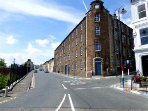
The B507 (former B508) Abercorn Road

The B508 was a short link road to the south of Derry city centre. It was the highest-numbered Class II road in Northern Ireland in the original 1923 road lists but the B508 number no longer exists.

The road started on the A2 on the northern side of the Craigavon Bridge and headed west along Abercorn Road before turning left into Bishop Street, away from the city centre. The road ended at the far end of that road on the B71, which quickly became the A40.

Owing to the short length of the B508 it is not certain how long the number lasted. Abercorn Street is now part of a rerouted B507 and Bishop Street is unclassified.


B508 (Northern Ireland)
Places
Related Pictures
View gallery (1)
B507 Abercorn Road, Derry - Londonderry - Geograph - 3545585.jpg
Other nearby roads
Derry
A2 (Northern Ireland) • A5 (Northern Ireland) • A6 (Northern Ireland) • A40 (Northern Ireland) • A514 (Northern Ireland) • A515 (Northern Ireland) • B48 (Northern Ireland) • B71 (Northern Ireland) • B193 (Northern Ireland) • B194 (Northern Ireland) • B507 (Northern Ireland) • B521 (Northern Ireland) • B522 (Northern Ireland) • B523 (Northern Ireland) • B524 (Northern Ireland) • B525 (Northern Ireland) • B526 (Northern Ireland) • B527 (Northern Ireland) • B528 (Northern Ireland) • B529 (Northern Ireland) • B530 (Northern Ireland) • C501 (Northern Ireland) • C502 (Northern Ireland) • C503 (Northern Ireland) • C508 (Northern Ireland) • C516 (Northern Ireland) • C568 (Northern Ireland) • C571 (Northern Ireland) • C572 (Northern Ireland) • C573 (Northern Ireland) • C574 (Northern Ireland) • C575 (Northern Ireland) • C576 (Northern Ireland) • C577 (Northern Ireland) • C578 (Northern Ireland) • C579 (Northern Ireland) • C581 (Northern Ireland) • Causeway Coastal Route • E16 • E100 • E117 (Old System) • M23 (Northern Ireland) • N13 • R236 • R237 • R238 • T3 (Northern Ireland) • T7 (Northern Ireland) • T17 (Northern Ireland) • T22 (Northern Ireland) • T59 • T73 • T74 • Wild Atlantic Way
B200-B539 in Northern Ireland
B200 • B201 • B202 • B203 • B204 • B205 • B206 • B207 • B208 • B209 • B210
B500 • B501 • B502 • B503 • B504 • B505 • B506 • B507 • B508 • B509 • B510 • B511 • B512 • B513 • B514 • B515 • B516 • B517 • B518 • B519
B520 • B521 • B522 • B523 • B524 • B525 • B526 • B527 • B528 • B529 • B530 • B531 • B532 • B533 • B534 • B535 • B536 • B537 • B538 • B539


SABRE - The Society for All British and Irish Road Enthusiasts
Discuss - Digest - Discover - Help