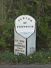
B6016
| B6016 | ||||
| Location Map ( geo) | ||||
| ||||
| From: | Lower Hartshay (SK376519) | |||
| To: | Selston (SK459528) | |||
| Distance: | 6.5 miles (10.5 km) | |||
| Meets: | B6013, B6179, B6017, B600 | |||
| Highway Authorities | ||||
| Traditional Counties | ||||
| Route outline (key) | ||||
| ||||
Route
The B6016 links the B6013 to the B600 in the east Midlands.
The B6016 begins on the B6013, close to that road's junction with the A610, and heads east. It crosses the course of Ryknild Street before running through the village of Pentrich.
At the far end of the village, the road makes a right-angle turn to the east then passes over the A38, with no junction, before running through Swanwick. Here the road negotiates a roundabout (where the original road rejoins the modern road: see below) then has a junction with the B6179 (the old A61).
The road then continues through Swanwick into Somercotes, where the main part of the road makes another right-angle turn and heads off toward the south, but the B6017 (marked on some maps as a spur of the B6016) continues without making the right-angle turn and meets the B600 early, in a more northerly location than our road.
After the right-angle turn and the junction with itself, the main part of the B6016 continues to the south and leaves Somercotes, making two more right-angle turns in the process.
From there the road continues into Ironville and Jacksdale, then up to Selston where it meets the B600 (which was originally the A613).
History
The B6016 originally started in Swanwick on the modern B6179 (which was at the time the A61). It began in a sort of triangle shape, starting at the junction of High Street (B6016) and Derby Road (A61) from where it ran Southwards down High Street, then turned East onto The Green, before again meeting the A61 and then following the remainder of the modern route to Selston as shown on the left.


