B682
| B682 | ||||
| Location Map ( geo) | ||||
| ||||
| From: | Bulwell (SK542460) | |||
| To: | Sherwood (SK567415) | |||
| Distance: | 3.7 miles (6 km) | |||
| Meets: | A6002, B6004, A6514, A6130, A60 | |||
| Former Number(s): | A611 | |||
| Primary Destinations | ||||
| Highway Authorities | ||||
| Traditional Counties | ||||
| Route outline (key) | ||||
| ||||
Route
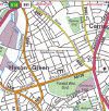
The B682 is an urban B-road to the north of Nottingham city centre.
Our road starts at a set of traffic lights with the A6002, where at this point traffic for the A6002 must turn right whereas our road carries straight on towards Bulwell town centre. A mini-roundabout takes some traffic off to our left, where there is a shopping centre.
Now we are in the centre of Bulwell, with several sets of traffic lights to contend with. Originally, the B682 ran along the High Street, but this has been pedestrianised for some time now so the road must arc around the west side of the High Street, connecting with the unclassified Cinderhill Road (which eventually meets up with - and at one time was - the B6008) at a set of traffic lights. We turn left here, and around a left-right hairpin, to bring us back onto the old alignment.
Passing over the Robin Hood railway line, we head into the suburbs, a mixture of old Victorian terraces, larger "villas", and 1960s regeneration estates. These estates eventually merge with the old terraces that make up Basford. A sharp left here brings us parallel with the Robin Hood line (behind the wall on the right). We get a glimpse of the railway when we reach the David Lane junction, and meet the B6004. We cannot access the B6004 directly in either direction as there is no turning onto the level crossing owing to the tightness of the turn and sequencing of the lights. In order to access the B6004 in either direction means taking the left turn beforehand, and using a mini-gyratory of sorts.
We carry straight on, still alongside the railway, until we reach the Basford tram stop. Here there is a mini-roundabout. Straight on takes us on a short spur to the A6514 Ring Road at Radford Road; the main route turns left, which also takes us to a crossroads with the Ring Road, but we are taking a slightly easterly route, and into New Basford. With terraces on our right, and industry on our left, the road is wide, allowing bus lanes to appear on each side.
At the Star Crossroads (named after the pub and garage), the road narrows again to just two lanes, and climbs a hill. At the top of the hill we bend to the right and pass a mosque and college. It gets very busy here, with many humped pedestrian crossings. After the college the road starts heading downhill again, with larger Victorian terraces and villas lining the road as we pass alongside the Forest Fields district. At the bottom of the hill, there is a small amount of newish development on the left. This area was originally the site of Carrington station, built in a cutting between two tunnels. It was a short lived station owing to its proximity to Victoria station, so the cutting was filled in around 1980. Just after the old station is the end of our road, at a double roundabout with the A6130 "Boulevards" and the A60 outside the Open University buildings.
History
There have been quite a few changes to the B682 since the road numbers were first decided upon in 1922. Originally, the road that is now the B682 was split into two parts. The section from Bulwell to the Ring Road was the A611 (in turn the current A611 was the B683); the old A611 then used the Radford Road to end up in Nottingham. The section from the Ring Road to Sherwood was the original route of the B682.
| B682 | ||||
| ||||
| ||||
| ||||
| ||||
|


