B846
| B846 | ||||
| Location Map ( geo) | ||||
| ||||
| From: | Aberfeldy (NN853491) | |||
| To: | Rannoch Station (NN423578) | |||
| Distance: | 37.2 miles (59.9 km) | |||
| Meets: | A826, A827, B8019, B847, station yard | |||
| Highway Authorities | ||||
| Traditional Counties | ||||
| Route outline (key) | ||||
| ||||
The B846 is one of the longer, and most variable, B-roads in Scotland. It starts in the Perthshire town of Aberfeldy, on the banks of the River Tay, and ends in the midst of the wilderness that is Rannoch Moor. Along the way there are pretty villages, stunning scenery and total desolation!
Route
Aberfeldy - Tummel Bridge
The route starts at a signalised crossroads on the A827 at the western end of Aberfeldy, with the A826 making the fourth arm of the crossroads, and heads north. Soon it crosses General Wade's Aberfeldy Bridge across the River Tay - a signalised S1 section - and runs through an avenue of trees before turning to head west along the northern edge of the Tay's floodplain at Weem. This section of Strathtay is surprisingly populated, with a series of farmsteads and hamlets along the roadside, and stretching up the hill above. These settlements are collectively known as Appin of Dull, but the fine views across Strath Tay make it far from a dull drive! A sign welcoming drivers to Dull notes that the area is twinned with Boring, Oregon. The road is generally a narrow S2, with a series of shortish straights between kinks, some being sharper than others. It is therefore generally better aligned, and faster than the A827 on the far side of the Tay. Just above the confluence of the two rivers, the B846 finds the banks of the River Lyon, and soon after a left turn crosses Comrie Bridge to head to the A827 at Kenmore. This provides a useful route for those in the know, which is often quicker than the main road.
Half a mile further on, at Keltneyburn, another left turn follows the River Lyon west to Fortingall and on, deep into the picturesque Glen Lyon. The B846 shrinks from S2 to single-track beyond the junction, although the passing places are plentiful and it often feels two cars wide. The road is now heading north again, following the route (either exactly or alongside) of General Wade's Military Road as it climbs steadily above the Keltney Burn through Glen Goulandie. This is known as the Pass of Keltney, with the road twisting and turning as it climbs. It is often hemmed in by trees on both sides, preventing traffic from seeing the views, but as it climbs higher, the trees thin a little and then disappear just below the farm and holiday site at Glengoulandie. The road is now high in the hills, passing through some stunning scenery, and still it climbs.
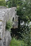
Just before the summit of 386m, the unclassified Schieallion Road turns off to the left, crossing the lower slopes of this famed mountain and creating a shortcut to Kinloch Rannoch. This makes a pleasant, and popular circular tour if you are so inclined! After the summit, the road drops once more, as it winds down quite sharply in places, between forestry plantations and patches of older native woodland. The road is wider again, mostly S2 now and about a mile below the summit it negotiates a steep near hairpin bend, before a long snaking straight. A right turn leads off to Foss and along the north shore of Loch Tummel, while the B846 continues to descend through the trees to Tummel Bridge. After passing the massive switching station, the road finds the bank of the River Tummel, and just after the power station it swings left to cross Tummel Bridge. This bridge was also built by General Wade, with the village growing up around it.
Tummel Bridge - Rannoch Station
Once across the bridge, the road meets the B8019 at a T junction, but keeps priority as it slowly turns back west along the north bank of the River Tummel. Half a mile or so further on, a right turn climbs away over the hills towards the B847 at Trinafour. This is the route of the military road, so from now on the B846 is a much newer route. Although following the river west, there are meadows and woodlands between the two as far as the dam which supplies the Tummel Bridge power station via an open aqueduct on the far side of the valley. Just beyond the dam, at Dunalastair, the road climbs over a low knoll, dropping sharply down to the reservoir beyond. It then meets the B847 at a sharp fork facing west. This is the last classified junction, but there is still over 15 miles to the end of the road!
A windy section along the reservoir follows, but this predates the creation of the reservoir, whose water level seems to have risen to meet the road and no more. The road then straightens up as it slowly converges with the River Tummel, enjoying a tree lined run along the river bank into the pretty little village of Kinloch Rannoch, with its churches, cottages and misshapen village square. This remote outpost is well worth visiting, and makes an excellent base for exploring the vast hinterland to the west. From the square, a side road crosses Kinloch Rannoch Bridge, and connects up with the Schieallion Road, and the road along the south shore of Loch Rannoch. At the end of the village, the B846 turns sharply right to curve along the shore of the Loch, and passes a large hotel on the hill above. The road follows the loch shore closely as it darts in and out of the trees, alternating from being almost on the waters edge, to climbing over slight rises. It also turns inland a couple of times to cross the wee mountain streams that have created wide meadows at their mouths.
The further west the road gets, the more densely populated the loch shore seems to become, with a steady run of houses and farms dotted along the roadside as it passes through the scattered settlement of Bridge of Ericht. The bridge itself carries the road over the River Ericht, again a little inland from the loch shore. Soon after, the road approaches the head of the loch, and again turns away from the water, this time for the last time as it climbs a little past the junction with the road along the south shore at Bridge of Gaur at the western end of the loch. There are no other road junctions on the B846 from here on, so anyone continuing west for the last five miles will have to retrace their steps (or get a train).
The road now climbs up alongside the River Gaur, past Loch Eigheach and its power station. This section of the route is the most desolate, the landscape dominated by a parallel line of electric poles and pylons, the rest a bleak stretch of bracken coated rocky lumps and bumps. The northern end of Loch Eigheach is skirted, adding a little relief, with the distant grey hills on the far side of Rannoch Moor appearing larger. Another bleak section follows, along a series of undulating straight, to reach Rannoch Station at 300m above sea level at the eastern end of Loch Laidon. The road ends in the station car park; there is a hotel and tea room too, but not a lot else. The displays in the station explain a little about Rannoch Moor and the railway line across it.
Westward Extension
There have, over the years, been many plans to extend this road west across the moor. Most would see it roughly following the track/path that crosses to Black Corries and Kingshouse on the A82. Thomas Telford was the first to suggest such a route as one of his Highland Roads, but even as late as the 1930s when the A82 was significantly upgraded across the moor, there was talk of a new east-west road. Sadly for motorists nothing was ever built, but it has helped preserve one of the UK's greatest wildernesses.
History
As noted above, the section from Aberfeldy to Tummel Bridge was originally built by General Wade in the 1720s as part of his military road connecting Crieff and Inverness. Although most of the route is more or less still the same, there are a few notable deviations and realignments where traces of the old road can be found. The first comes right at the very beginning, where it has often been said that the road originally crossed the meadows from Aberfeldy Bridge to Weem at an angle to the current avenue. Different sources postulates different trajectories, but there is nothing obvious in the landscape to support this idea, and in most other similar cases, a field boundary survives, or at least something shows up in aerial photography.
For many miles there are few suggestions that the B846 deviates substantially from Wades line. Above Keltneyburn, there are tracks and marks in the field above the current road which could possibly indicate the old road line sitting higher up the slope, but there is no obvious connection at the southern end, and it seems most likely that these are newer farm tracks, since abandoned again. Above Glengoulandie, a much more certain stretch of old road can be found on the hillside to the east of the B846. Again, the southern connection is difficult to locate, but the banks and ditches of the military road can be clearly followed across the hillside for about half a mile.
Across the summit and into the forest, a wide forestry entrance is reached on the right. Here, the B846 swings a little to the left, with a fence line continuing ahead up a bank. The line of the old road can be traced alongside this fence for about 500m before it kinks left and rejoins the current road. The history of the road then becomes more complex as it approaches the 'hairpin' bend. There is a suggestion that the old road once cut down more steeply through the trees, perhaps following the fence line marked on the modern OS Explorer maps. However, the OS Six Inch map, shows more pronounced bends to the south of the current line before the hairpin. Neither route is identifiable on aerial photography, and an initial investigation on the ground yielded little.
The long straights of the B846 as it continues to Tummel Bridge are archetypal of the military roads, but one is most definitely not. The road previously passed much closer to Kynachan Lodge, using the current western drive and a route close to the southern drive. However, this section seems to have been bypassed when Loch Tummel was dammed in the late 1950s, despite the water levels never quite reaching the old road. Tummel Bridge, as with Aberfeldy Bridge at the beginning of the route, was built by Wade, and soon after the B846 leaves the old military road, which turns off to cross the hills to Trinafour.
The draft proposals for the 1935 renumberings would have seen the B846's eastern end re-routed along the B8019 to the A9, the existing route into Aberfeldy renumbered as an extended B847. While this sensible suggestion is marked as 'Agreed', it was never carried through. As such the B846 is unchanged from its 1922 route.


