Bartholomews Mapping
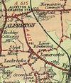
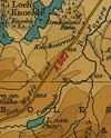
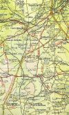
| Pictures related to Bartholomews Mapping View gallery (113) |
Bartholomews maps were first published in c1826, although it was not until 1875 that a comprehensive range of maps covering Scotland was launched. This was extended in 1897 to also cover England & Wales. The maps were very popular in the first half of the twentieth century, the 'Half Inch' series giving the OS a good run for their money. However, by the 1980s sales were in rapid decline as the OS Landranger series was launched. This was despite Bartholomews converting their maps to 1:100,000, albeit as a photo-enlargement of the Half Inch mapping. By the 1990s only the most popular sheets were still being revised and in print. Then, in 1995, Bartholomews merged with Harper Collins, and the 1:100,000 range was quietly dropped by 1999.
List of Maps
A list of the changes to Bartholomew's mapping from 1875 to 1999.
See the Bartholomews Map Lists for individual sheet information.
| Year From | Year To | Map Name | Scale | Notes |
|---|---|---|---|---|
| 1875 | 1886 | Reduced Ordnance Maps of Scotland | 1:126,720 | Scotland, 30 'District Sheets' |
| 1890 | 1895 | Reduced Ordnance Survey Maps of Scotland for Tourists and Cyclists | 1:126,720 | Scotland, 29 Sheets |
| 1896 | 1926 | New Reduced Survey for Tourists & Cyclists | 1:126,720 | Scotland, 29 Sheets |
| 1897 | 1903 | Reduced Ordnance Survey for Tourists & Cyclists | 1:126,720 | England & Wales, 37 Sheets |
| 1904 | 1920 | New Reduced Survey for Tourists & Cyclists | 1:126,720 | England & Wales, now shows First & Second class roads |
| 1922 | 1927 | Revised Half-Inch to Mile for Motorists & Cyclists. | 1:126,720 | Scotland |
| 1924 | 1926 | Revised Half-Inch to Mile for Motorists & Cyclists | 1:126.720 | England & Wales |
| 1926 | 1936 | Revised half-Inch Contoured Maps | 1:126,720 | England & Wales |
| 1927 | 1937 | Revised “Half-Inch” contoured maps | 1:126,720 | Scotland |
| 1936 | 1943 | Revised “Half-Inch” Contoured Maps | 1:126,720 | Intermediate range of 62 sheets, with Scotland and England & Wales series slowly being merged. |
| 1940 | 1974 | Revised “Half-Inch” Contoured Maps | 1:126,720 | Final range of 62 sheets covering England, Wales & Scotland. Great Britain added to title from 1961. |
| 1974 | 1999 | National Map Series 1:100,000 | 1:100,000 | Photo Enlargement of 'Half Inch' series to compete with OS Landranger. |
| c1933 | Quarter Inch Automobile Map of Great Britain | 1:253440 | AA Map series covering GB in 23 sheets. Excludes Orkney, Shetland and Western Isles. | |
| c1938 | Duplex Map 8miles to the Inch | 1:506,880 | Two double sided sheets: Scotland & Northern England; England & Wales |
| Bartholomews Mapping | ||||||||
| ||||||||
|


