Black Country Spine Road
| Black Country Spine Road | |||
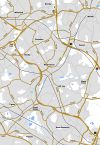
| Location Map ( geo) | |||
 | |||
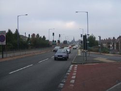
| The Spine Road at Moxley | |||
| |||
| Location | |||
| Bilston • Wednesbury • West Bromwich | |||
| County | |||
| Staffordshire | |||
| Highway Authority | |||
| Wolverhampton • Walsall • Sandwell | |||
| Scheme Type | |||
| Bypass | |||
| Opening Date | |||
| In sections between 1995 and 1997 | |||
| On road(s) | |||
| A41 • A4444 | |||
The Black Country Spine Road (or Black Country New Road) is a completed road scheme in the Black Country connecting the A463 Black Country Route on the southeast side of Wolverhampton and the 1970s constructed West Bromwich Expressway via the A41 and A4444. It therefore indirectly connected the M5 at junction 1 with the M6 at junction 10.
The road formed a bypass for a congested section of Thomas Telford's Holyhead Road, particularly through Wednesbury Town Centre. This section of Holyhead Road was extremely built up, and followed a poor alignment, including the climb up to Hill Top. Improvement to this section therefore required a totally new route to be found, not an easy task through the urban area.
History
The road was first proposed in 1988, and proceeded quickly to a public inquiry held in September 1989. However, in May 1990 the Department for Transport announced a review of the road due to an escalation of costs, and on 18 July 1991 they annouced that they would not support the full proposed scheme and that they would only support the southern section of the scheme between Leabrook Road, Wednesbury (now the site of Parkway Roundabout) and Albion Roundabout at Carter's Green, West Bromwich, and then only if all the proposed grade separation was deleted. The northern section was later re-added, but in order to save costs instead of the proposed off-line route to the west of the A41 between Moxley Junction and Patent Shaft Roundabout, an almost on-line upgrade was completed, with the new dual carriageway being placed immediately to the west of the original Holyhead Road.
Work started on the road in late 1993, and completion was in stages between 1995 and 1997.
Upon completion, the majority of the former route was given the new number A4196, with the exception of a small section to the north of Wednesbury town centre which became an unclassified road.
Opening Dates
| Date | Section |
|---|---|
| July 1995 | The Lunt Junction - Moxley Junction |
| April 1997 | Moxley Junction - Patent Shaft Roundabout |
| November 1995 | Patent Shaft Roundabout - Navigation Roundabout |
| July 1995 | Navigation Roundabout - Albion Roundabout |
This page includes a scan of a non-free copyrighted map, and the copyright for it is most likely held by the company or person that produced the map. It is believed that the use of a limited number of web-resolution scans qualifies as fair use under United States copyright law, where this web page is hosted, as such display does not significantly impede the right of the copyright holder to sell the copyrighted material, is not being used to generate profit in this context, and presents information that cannot be exhibited otherwise.
If the copyright holder considers this is an infringement of their rights, please contact the Site Management Team to discuss further steps.


