Bromsgrove
| Bromsgrove | |||
| Location Map ( geo) | |||
 | |||
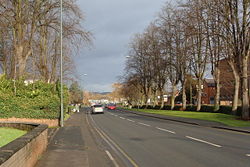
| The A448 passing through the town centre | |||
| |||
| County | |||
| Worcestershire | |||
| Highway Authority | |||
| Worcestershire | |||
| Forward Destination on | |||
| M5, M42, A38, A448 | |||
| Next Primary Destinations | |||
| Birmingham • Kidderminster • Redditch • Stourbridge • Worcester | |||
| Places related to the M5 | |||
Bristol • Worcester • Birmingham • Taunton • Exeter • Bridgwater • Weston-super-Mare • Avonmouth • Gloucester • West Bromwich • Droitwich Spa • Wellington (Somerset) • Tewkesbury • Cheltenham | |||
| Places related to the M42 | |||
| Places related to the A38 | |||
Bristol • Plymouth • Bodmin • Liskeard • Worcester • Lichfield • Birmingham • Derby • Taunton • Exeter • Bridgwater • Burton upon Trent • Gloucester • Mansfield • Droitwich Spa • Ripley • Alfreton • Wellington (Somerset) • Tewkesbury • Saltash • Torpoint | |||
| Places related to the A448 | |||
Bromsgrove is a Primary Destination in the north of Worcestershire where the M5 meets the M42 and the A38 meets the A448.
History
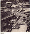
Historically the town was a bottleneck on the A38 route to the South West; now traffic bypasses the town on the M5 which opened in 1962. Later in the 1970s the town received a second bypass, known as the Bromsgrove Eastern Bypass. The northern section of the route between Lickey End and Aston Fields was new construction, linking in to the A4024 which was incorporated as the southern half of the bypass.
During the reconstruction and widening of the M5 in the 80s and 90s, several improvements were made to the A38 around the town to cater for the extra traffic diverting off the motorway. This mostly included the provision of extra traffic signals at junctions and right turn refuges.
The A491 used to pass through the town centre to terminate in Finstall, however upon the completion of a link road between Fairfield and Lydiate Ash in 1963, the A491 was diverted along the new road, with the former route being renumbered as an extension of the B4091.
Routes
Several routes radiate from Bromsgrove.
| Route | To | Notes |
| The SOUTH WEST, SOUTH WALES | ||
| The NORTH, Birmingham | ||
| The NORTH EAST (M1) London (M40), NEC, Birmingham Airport | ||
| Birmingham | ||
| Worcester | ||
| Kidderminster | ||
| Redditch | ||
| Stourbridge | ||
| Stourbridge | Renumbered as part of the A491 when the A449 was extended to South Wales | |
| Halesowen | Downgraded to B4551 following the completion of the M5 | |
| Stoke Heath | Now forms part of the Bromsgrove bypass | |
| Catshill, Fairfield | ||
| Hanbury | ||
| Worcester (A38) | Short section of former A38 linking the B4091 to the A38 | |
| Lickey | ||
| Burcot | ||
| Tardebigge | ||
| Bellbroughton | ||
| Romsley, Halesowen | Former route of the A459 |
Highways Management
Most roads in the district of Bromsgrove are managed by Worcestershire County Council, with the exception of the M5 and M42 which are Trunk Roads and therefore managed by National Highways. Until 2002, much of the A38 through the district was also a Trunk Road.
Named Junctions
Several junctions in the Bromsgrove (district) area have names.
| Image | Name | Classified Road(s) | Grid Reference | More Info | Map |
|---|---|---|---|---|---|

|
Slideshow Island | A38 / A448 | SO968707 | ||

|
Hanbury Turn | A38 / B4091 | SO947684 | ||

|
Stoneybridge Island | A491 / B4091 | SO947761 | ||

|
Harvester Roundabout | M42 / A38 / B4096 | SO969730 | Often also referred to as Forest Roundabout |


