Star.pngStar.pngStar.pngStar grey.pngStar grey.png

C40 (Staffordshire)

From Roader's Digest: The SABRE Wiki
Jump to navigation Jump to search
C40
Location Map ( geo)
Cameraicon.png View gallery (8)
From:  Oaken (SJ896035)
To:  Pendeford Mill (SJ853024)
Via:  Bilbrook
Distance:  3.1 miles (5 km)
Meets:  A41 • C6 • C217 • C260 • C272 • U119
Highway Authorities

Staffordshire

Traditional Counties

Staffordshire

Route outline (key)
C40 Pendeford Mill - Oaken
This article is about the Class III road numbered C40 by Staffordshire Council.
For other roads that are numbered C40, see C40
.
The eastern end of the C40

Staffordshire County Council's locally classified C40 forms a continuation of the City of Wolverhampton Council's U119, essentially forming a link between the Wolverhampton commuter village of Bilbrook, and the A449 (and then onto the M54 at junction 2) in the one direction, and the A41 towards the M54 at junction 3 and Telford in the other direction.

Route

The route starts at the local authority boundary at Pendeford Mill, just to the west of Pendeford Business Park. Initially, the road is in a semi-urban environment, with a T-junction with the C272 (which heads off to the nearby village of Coven) following almost immediately, before passing the former Boulton Paul aircraft factory, location of the construction of the Defiant during World War II; then crossing the Shropshire Union Canal before entering the commuter village of Bilbrook, which forms a small conurbation with the larger attached village of Codsall.

The road passes through a fairly unremarkable urban environment before meeting the C6 at a double mini roundabout junction across a bridge over the Wolverhampton - Shrewsbury railway line, also the location of Bilbrook station.

Beyond this junction, the road continues to pass through residential areas (including the unusually named Suckling Green Lane) before meeting the C260 at Histons Hill, where the route has a TOTSO to the left before meeting the C217 after about 100 yards on Oaken Lane. The road now disappears as the junior partner in a multiplex for about 130 yards northwards, before striking back out on its own once more along the rural Holybush Lane, before passing through the hamlet of Oaken as Shop Lane before terminating as a T-junction on the A41.


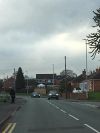
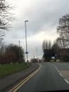
C40 (Staffordshire)
Crossings
Related Pictures
View gallery (8)
Codsall filling station and road junction - Geograph - 1820826.jpgCodsall 3 (12th December 2018)..jpgIMG 1478.JPG Duck Ln Bilbrook.jpgIMG 1478.JPG iridiums.jpgIMG 1476.JPG v-max and iridium.jpg
Other nearby roads
Wolverhampton
A41 • A446(M) • A449 • A454 • A457 • A459 • A460 • A462 • A463 • A464 • A464 (Oaken - Nantwich) • A4038 • A4039 • A4098 • A4123 • A4124 • A4126 • A4150 • A4444 • A4510 • B4155 • B4156 • B4157 • B4158 (Wolverhampton) • B4159 • B4160 (Wolverhampton) • B4161 • B4162 • B4162 (Monmore Green - Deepfields) • B4163 • B4164 (Moxley - Ocker Hill) • B4200 • B4454 (Wednesfield) • B4464 • B4483 • B4484 • B4563 • B4590 • Bilston Link Motorway • C6 (Staffordshire) • C17 (Dudley) • C19 (Dudley) • C20 (Dudley) • C59 (Staffordshire) • C60 (Staffordshire) • C77 (Staffordshire) • C78 (Staffordshire) • C84 (Staffordshire) • C99 (Staffordshire) • C108 (Staffordshire) • C114 (Staffordshire) • C116 (Staffordshire) • C125 (Staffordshire) • C131 (Staffordshire) • C137 (Staffordshire) • C153 (Staffordshire) • C169 (Staffordshire) • C170 (Staffordshire) • C184 (Staffordshire) • C198 (Staffordshire) • C227 (Staffordshire) • C234 (Staffordshire) • C235 (Staffordshire) • C253 (Staffordshire) • C259 (Staffordshire) • C260 (Staffordshire) • C272 (Staffordshire) • C273 (Staffordshire) • C307 (Staffordshire) • C335 (Staffordshire) • C342 (Staffordshire) • C500 (Staffordshire) • E33 (London - Glasgow) • E34 (Old System) • Holyhead Road • M6 • M6 Toll • M54 • NCN81 • Northern and Western Motorway • T11 (Britain) • T14 (Britain) • T49 (Britain) • T50 (Britain) • U99 (Wolverhampton) • U110 (Wolverhampton) • U111 (Wolverhampton) • U112 (Wolverhampton) • U113 (Wolverhampton) • U114 (Wolverhampton) • U115 (Wolverhampton) • U116 (Wolverhampton) • U117 (Wolverhampton) • U118 (Wolverhampton) • U119 (Wolverhampton) • U120 (Wolverhampton) • U121 (Wolverhampton) • Western Orbital • Wolverhampton Outer Ring Road


SABRE - The Society for All British and Irish Road Enthusiasts
Discuss - Digest - Discover - Help