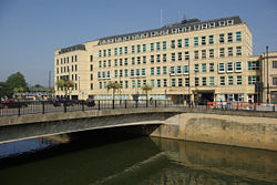
Churchill (Southgate) Bridge
| Churchill Bridge | |||
| Location Map ( geo) | |||
 | |||
| |||
| From: | Bath City Centre | ||
| To: | Wellsway | ||
| County | |||
| Somerset | |||
| Highway Authority | |||
| Bath and North East Somerset | |||
| Additional Information | |||
| |||
| On road(s) | |||
| A36 • A367 • A3039 | |||
| Crossings related to the A36 | |||
Churchill Bridge
The Churchill Bridge across the River Avon at the southern end of Bath City Centre is a relatively new structure. It was built in the 1960s to replace the earlier Southgate Bridge which marked the site of the original Roman Crossing. The bridge is dualled, albeit as little more than turning lanes for the junctions on either side of the river. On the south side, we meet the Roundabout (below), while to the north, traffic reaches a one-way system, which formerly included running around the reverse-dualled Ambury (to maintain two neighbouring one-way systems traffic appeared to flow on the wrong side of the central reservation), however with major redevelopment work ongoing in the area, the southbound lanes are currently (summer 2016) closed to traffic.
Southgate Bridge
The current Southgate Bridge is no more than a pedestrian crossing which leads to a subway under the A36 Claverton Street, and so to the residential areas of Holloway, Bear Flat and Beechen Cliff. However, for centuries this was the site of the main road crossing on the Wells Road. The Romans probably had a bridge here, and so the site was reused through the years until the planners of the 1960s decided that enough was enough. To be fair, the new bridge provides a much better connection onto the roundabout.
The Junction
The Junction between the A367 and A36 is an elongated roundabout underneath the Railway line. Originally, a much smaller roundabout existed here, using the twin portals of Brunel's Railway Bridge, but when the area was re-planned in the 1960s, Wells Road was re-aligned and the Churchill Bridge (above) built, to allow a much larger roundabout to be installed. At the north and west exits, the left hand lane is for turning only, allowing a freer flow onto the roundabout at these points too, albeit still with give-way lines to allow traffic on the roundabout to move for the next exit. However, the south and east exits don't offer this assistance, and with the added hindrance of an obscuring railway bridge, this can make entrance onto the roundabout from the west a tricky manouvere, especially if you aren't taking the first exit.
Routes
| Route | To | Notes |
| Bristol (A4), Royal United Hospital, Wells (A39) | ||
| Warminster, RNHRD, Chippenham (A4), Stroud (A46), Motorway M4, | ||
| Radstock, Shepton Mallet (A37) | ||
| City Centre |


