Ermin Street
| Ermin Street | |||
| Location Map ( geo) | |||
| |||
| From: | Silchester (SU634625) | ||
| To: | Gloucester (SO843190) | ||
| Via: | Cirencester | ||
| Old route now: | B4000, A419, A417 | ||
| Primary Destinations | |||
| Traditional Counties | |||
For Ermine Street the Roman Road from London to York, see Ermine Street.
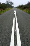
As with so many of the named Roman Roads in Britain, Ermin Street almost shares a name with Ermine Street to the east. However, this is the road from Silchester CALLEVA ATREBATUM to Gloucester GLEVUM. Silchester today is a rather insignificant little place in north Hampshire, disconnected from the major road network. However, in Roman times it was an important cross-roads. The road from London approaches from the east, with the Winchester road heading south. The Old Sarum (Salisbury) road departs to the south west, and our road, Ermin Street, heads west, initially for Newbury.
While the exact course of the Roman route was probably not on the same alignment, Pamber Road, Soke Road and Red Lane are the closest to it. After crossing some fields, the Roman route seems to briefly follow the A4 from Thatcham to Newbury, but then as we leave Newbury the B4000 is quite clearly the Roman route in places, as it shadows the M4. However, just before Membury Services, the B4000 turns off, and the Ermin Street follows Baydon Road across the motorway, through Baydon and back across the M4.
Continuing along Callas Hill, through Wanborough and so to the A419 on the edge of Swindon. However, this is only a brief flirtation with a primary route, as the old Ermin Street passes along the B4006 and B4141 in Swindon's North eastern suburbs. It then crosses the re-aligned A419 to follow Turnpike Road, the aptly named Ermin Street and Blunsdon Hill back to the A419. Apart from the Latton Bypass, the two routes are one all the way into Cirencester, where we cross the Fosse Way.
The route through the town seems to be Watermoor Road, Cricklade Street, West Market Place and Gloucester Street, to briefly pick up the A435. Gloucester Road carries us through Stratton, and on to the A417. This route is then followed as far as Birdlip above the Air Balloon Roundabout, with the Roman Road taking the more direct route down the hill, entering Brockworth via Ermin Way and Cirencester Road. Ermin Street, Hucclecote Road and Barnwood Road lead us to the A38 at the Barnwood Roundabout, before we turn onto the B4063 London Road into the city centre, once entering through the Northgate.


