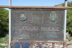
Erwood Bridge
Jump to navigation
Jump to search
| Erwood Bridge | |||
| Location Map ( geo) | |||
 | |||
| |||
| Location | |||
| Erwood (NW) | |||
| County | |||
| Brecknockshire • Radnorshire | |||
| Highway Authority | |||
| Powys | |||
| Opening Date | |||
| 1967 | |||
| Additional Information | |||
| |||
| On road(s) | |||
| B4567 | |||
Erwood Bridge stands close to the point where the B4567, running from the A481 1.5 km east of Llanelwedd along the left bank of the River Wye through Aberedw, meets the start of the B4594 Painscastle and Burlingjobb road. The bridge connects this junction to the A470 on the other side of the river. The village of Erwood lies on the A470 a kilometre south-east of the bridge.
Note that this bridge should not be confused with the much smaller one – also called Erwood Bridge on some maps – which carries the A470 across the Clettwr brook in Erwood village itself.
| Erwood Bridge | ||
| ||
|
