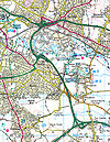
Fantasy Maps
Many SABRE members engage in a hobby of creating Fantasy Maps.
Fantasy maps can vary from the subtle to the extreme: anything from a realignment to a road near you to a plan for a new motorway through a national park or even a road layout for an entirely fictional land.
Generally, the more realistic your map is, the more likely people will be to engage with it. Sticking within realistic political, financial and engineering constraints may sound like a fun-killer, but it's what turns a bit of drawing into a serious challenge.
How To Draw
The most common question new members will ask about fantasy maps is "how do I make mine better" and the answer is almost always "spend more time on it".
There is no fast-track option for creating a good map. You will need to try a few programmes and see what works with you. Plenty of members have created excellent maps using the original version of Microsoft Paint: it just requires a lot of patience!
Of the most common freeware tools available, the most popular are Paint.NET and Inskape. You can use the standard version of Microsoft Paint but you will be missing out on a few features if you do - instead you'd be advised to install a better programme.
Importing A Map
At this stage it's important to note that almost all existing maps are subject to copyright restrictions. If you're planning on making some fantasy improvements to an existing map, you will struggle to share it without breaking any rules. SABRE cannot take responsibility for problems caused by sharing copyrighted material.
OpenStreetMap has one of the most easy-going copyright restrictions. You may wish to read their policy and work with that.
Once you have a map you wish to edit, you need to take a screenshot. Towards the top-right corner of your keyboard, look for a key with something like 'PrtSc', next to the functions. Press this, open your map programme, and paste the results.
Drawing A Map
Whether you have an existing map or a blank canvas, now the good stuff begins.
To work out exactly how to use your chosen programme you will need to read its manual, or just have a play with it. However the tools you're going to need are:
- colour picker: to match the existing colour scheme
- line and fill tools: for strip maps just the line tool will do; for other maps it's best to draw an outline and fill it
- eraser: to remove the roads you don't want (remember to match the colour of the background)
- layering: this means you can draw a new road without worrying about what it's covering up. You can also use this to fade out your background.
If your project involves drawing signs, Roads.org.uk's road sign fonts will be useful.
Common Mistakes
Technically, you can draw anything you like. However, there's not much point if it would be impossible to build in real life.
The first mistake is to make sure you have enough space for the roads your planning. Depending on the scale, maps will over- or under- exaggerate how wide a road is. Try to imagine how wide the existing roads on the map are, and then how wide your road will be in reality.
Secondly, when drawing fantasy interchanges, it's easy to completely underestimate just how big a fast-flowing interchange needs to be. Sometimes you need to step back, look at the surrounding land, and consider whether a car (let alone a lorry) can actually climb the slip road you've just drawn.
Similarly, a sharp bend can be just as bad (if not worse) than a roundabout. If you want a bend people can drive around fast, it needs to be really big. Plenty of real-world examples have taught us sharp bends attract crashes, and quickly become congested.
Maps Without Drawing
If you simply want to express or plan a fictional road, town or country, it is technically possible to do it without touching a line tool at all.
There are plenty of games (especially the older, isometric ones) which allow you to play with your own town or country. SimCity 4, Cities XL and even OpenTTD offer some-sort of road-building functionality, depending on what you're trying to achieve. You won't get anything as flexible as creating your own map, but you might find it easier to visualise.
Sharing Your Results
SABRE's Fantasy Map and Ideas thread is a good place to share the very best of your work.


