File:'Boston Stump' - Geograph - 3978.jpg

From Roader's Digest: The SABRE Wiki
Jump to navigation Jump to search

'Boston_Stump'_-_Geograph_-_3978.jpg(512 × 438 pixels, file size: 35 KB, MIME type: image/jpeg)

Y topleft.gifY topright.gif
Description:
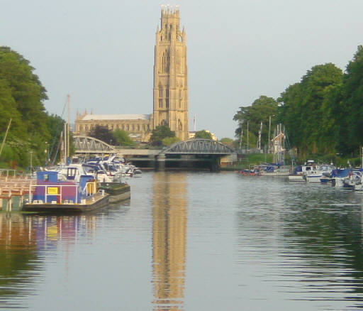
'Boston Stump' The tower of St Botolph's Church, Boston, is visible for many miles over the flat scenery of Lincolnshire and is known as 'Boston Stump'. Looking south east from the visitor moorings on the River Witham.
Location:52.981471, -0.027885
Road:
Date:31 07 2004
Photographer:(c) Copyright Martin Clark and licensed for reuse under this Creative Commons Licence
Source:Geograph

Map

Y btmleft.gifY btmright.gif

Galleries  | Boston

File history

Click on a date/time to view the file as it appeared at that time.

Date/TimeThumbnailDimensionsUserComment
current18:52, 26 March 2023Thumbnail for version as of 18:52, 26 March 2023512 × 438 (35 KB)Ross spur (talk | contribs)''''Boston Stump'''' The tower of St Botolph's Church, Boston, is visible for many miles over the flat scenery of Lincolnshire and is known as "Boston Stump". Looking south east from the visitor moorings on the River Witham.

The following page uses this file:

Metadata

SABRE - The Society for All British and Irish Road Enthusiasts
Discuss - Digest - Discover - Help