File:A4053 Coventry Ring Road Junction 2 - Coppermine - 13257.jpg

From Roader's Digest: The SABRE Wiki
Jump to navigation Jump to search

A4053_Coventry_Ring_Road_Junction_2_-_Coppermine_-_13257.jpg(640 × 480 pixels, file size: 67 KB, MIME type: image/jpeg)

Y topleft.gifY topright.gif
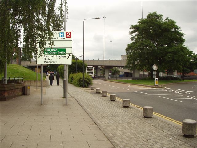
Description:A4053 Coventry Ring Road Junction 2

North east view looking from Hales Street towards the Ring Road showing the numbered junction direction sign, the problem of overgrown vegetation obscuring signs is quite common at the present time of year. The area north of the road is undergoing redevelopment and plans are afoot to close junction 2 to allow further redevelopment to take place although nothing has started on the road yet.

Originally uploaded to Coppermine on Jun 23, 2007 by leekman
Location:This picture currently has no coords, edit this page to add them.
Road:A4053
Date:6 2007
Photographer:Leekman
Source:Coppermine
Y btmleft.gifY btmright.gif

Galleries  | A4053 | Coventry

File history

Click on a date/time to view the file as it appeared at that time.

Date/TimeThumbnailDimensionsUserComment
current20:10, 20 January 2010Thumbnail for version as of 20:10, 20 January 2010640 × 480 (67 KB)Jeni (talk | contribs){{Information |description = '''A4053 Coventry Ring Road Junction 2''' North east view looking from Hales Street towards the Ring Road showing the numbered junction direction sign, the problem of overgrown vegetation obscuring signs is quite common at

There are no pages that use this file.
Metadata

SABRE - The Society for All British and Irish Road Enthusiasts
Discuss - Digest - Discover - Help