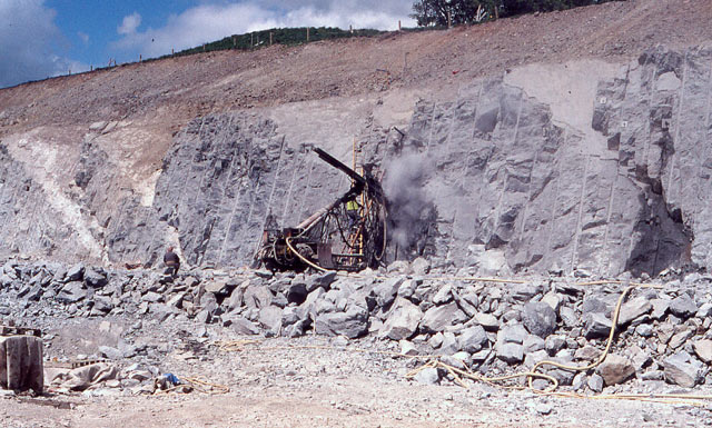
Construction of the A5 Ty Nant cutting in May 1995 just to the south-east of the failed slope. The drilling rig is installing ground anchors to tie together the faulted blocks of Silurian mudstone. One of the anchors can be seen protruding from a freshly-drilled hole just above the rig. The flat, triangular areas on the rock face are the outcrops of the faults which ultimately overcame the ground anchors and slipped again. A classic tale of ingenuity overcome by the complexity of real ground conditions. The image was captured, with permission, during an excursion of the North Wales Geology Association.
Location:
This picture currently has no coords, edit this page to add them.
{{Information |description = Construction of the A5 Ty Nant cutting in May 1995 just to the south-east of the failed slope. The drilling rig is installing ground anchors to tie together the faulted blocks of Silurian mudstone. One of the anchors can be s
