File:A6- spurious bypasses in Leicestershire - Coppermine - 14902.jpg
Jump to navigation
Jump to search

No higher resolution available.
A6-_spurious_bypasses_in_Leicestershire_-_Coppermine_-_14902.jpg (460 × 545 pixels, file size: 275 KB, MIME type: image/jpeg)
| |||||||||||||||||||||||||
|
Galleries | A6 | A6/Leicester - Derby | A6/history | A6/route | Loughborough | Other Mapping | ||
File history
Click on a date/time to view the file as it appeared at that time.
| Date/Time | Thumbnail | Dimensions | User | Comment | |
|---|---|---|---|---|---|
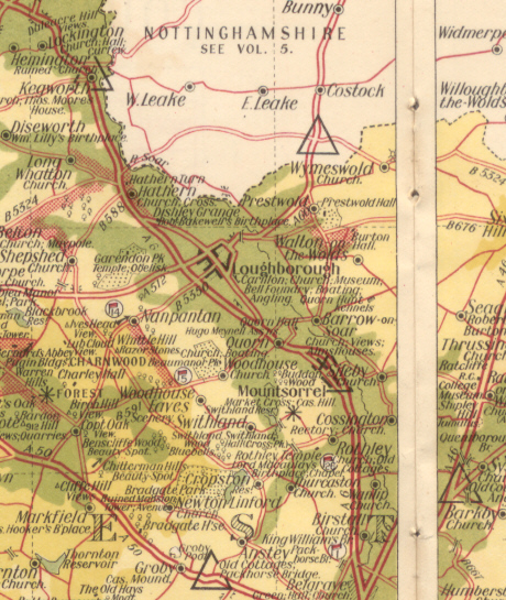
| current | 13:31, 11 May 2013 | | 460 × 545 (275 KB) | Nickdunn (talk | contribs) | '''A6: spurious bypasses in Leicestershire''' Note the bypasses of Loughborough and Mountsorrel... Both are now bypassed, but not like that! From the RAC County Road Map and Gazetteer of Leics, Northants, Hunts and Rutland, probably 1950s. <small>''O... |
File usage
The following 2 pages use this file: