File:A74 North of Moffat - Geograph - 94213.jpg

From Roader's Digest: The SABRE Wiki
Jump to navigation Jump to search

A74_North_of_Moffat_-_Geograph_-_94213.jpg(640 × 429 pixels, file size: 77 KB, MIME type: image/jpeg)

Y topleft.gifY topright.gif
Description:
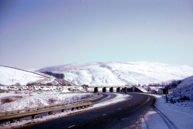
A74 North of Moffat
Since this picture was taken, the railway has been electrified, the A74 has been rebuilt as a motorway east of the railway and this road reduced to a single carriageway. (looking SE)
Location:55.395864, -3.537793
Road:A74
Date:16 02 1969
Photographer:� Copyright John Thorn and licensed for reuse under this Creative Commons Licence
Source:Geograph

Map

Y btmleft.gifY btmright.gif

Galleries  | A74 | WCML

File history

Click on a date/time to view the file as it appeared at that time.

Date/TimeThumbnailDimensionsUserComment
current00:39, 15 March 2010Thumbnail for version as of 00:39, 15 March 2010640 × 429 (77 KB)Jeni (talk | contribs)'''A74 North of Moffat'''<br/>Since this picture was taken, the railway has been electrified, the A74 has been rebuilt as a motorway east of the railway and this road reduced to a single carriageway. (looking SE)

The following page uses this file:

Metadata

SABRE - The Society for All British and Irish Road Enthusiasts
Discuss - Digest - Discover - Help