No higher resolution available.
File history
Click on a date/time to view the file as it appeared at that time.
| Date/Time | Thumbnail | Dimensions | User | Comment |
|---|
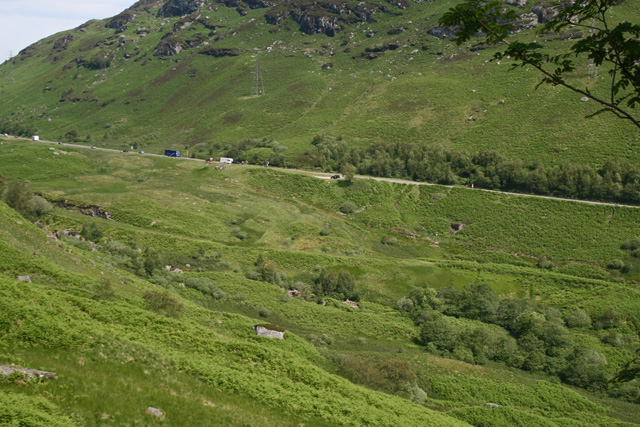
| current | 20:00, 4 July 2011 |  | 640 × 427 (177 KB) | Rileyrob (talk | contribs) | The old military road is picked out by a line in the vegetation below the modern A85 as it descends Glen Ogle to Lochearnhead. |
File usage
There are no pages that use this file.
This file contains additional information, probably added from the digital camera or scanner used to create or digitise it.
If the file has been modified from its original state, some details may not fully reflect the modified file.
