File:A860-cumbrae-1932.jpg
Jump to navigation
Jump to search

No higher resolution available.
A860-cumbrae-1932.jpg (234 × 170 pixels, file size: 47 KB, MIME type: image/jpeg)
| |||||||||||||||||||||||||
|
Galleries | A860 | Ten-Mile Road Map of Great Britain | ||
File history
Click on a date/time to view the file as it appeared at that time.
| Date/Time | Thumbnail | Dimensions | User | Comment | |
|---|---|---|---|---|---|
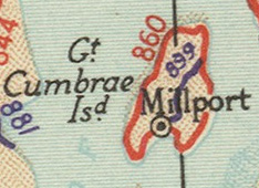
| current | 21:09, 31 May 2011 | | 234 × 170 (47 KB) | Rileyrob (talk | contribs) | The entire route of the A860 on Cumbrae as shown on the 1932 OS Ten Mile map |
File usage
The following 2 pages use this file: