File:Amersham 1932 OSMap.PNG
Jump to navigation
Jump to search

No higher resolution available.
Amersham_1932_OSMap.PNG (201 × 107 pixels, file size: 56 KB, MIME type: image/png)
| ||||||||||||||
|
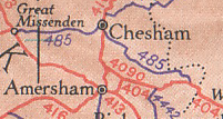
Galleries | B485 | A4090 (Amersham) | Amersham | Chesham | Ten-Mile Road Map of Great Britain | ||
File history
Click on a date/time to view the file as it appeared at that time.
| Date/Time | Thumbnail | Dimensions | User | Comment | |
|---|---|---|---|---|---|
| current | 20:27, 12 January 2010 | | 201 × 107 (56 KB) | Sabristo simon (talk | contribs) | {{Information |description = Amersham, Chesham and area off the 1932 OS Map |day = |month = |year = |photographer = |source = 1932 OS 10 Miles to 1" map |road = B485, A4090 |lat |
File usage
The following 3 pages use this file: