File:B8040.jpg
Jump to navigation
Jump to search

No higher resolution available.
B8040.jpg (447 × 432 pixels, file size: 109 KB, MIME type: image/jpeg)
| |||||||||||||||||||||||||
|
Galleries | A82/Fort William - Fort Augustus | A87 | B8040 | Bartholomews Mapping | ||
File history
Click on a date/time to view the file as it appeared at that time.
| Date/Time | Thumbnail | Dimensions | User | Comment | |
|---|---|---|---|---|---|
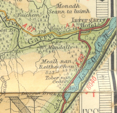
| current | 08:49, 1 January 2010 | | 447 × 432 (109 KB) | Rileyrob (talk | contribs) | {{Information |description = In 1939, the B8040 is still marked on the southern shore of Loch Oich |day = |month = |year = 1939 |photographer = |source = Barts Half Inch Sheet 54 |road = A82 |road2 = A87 |r |
File usage
The following 2 pages use this file: