File:B848.jpg
Jump to navigation
Jump to search

Size of this preview: 598 × 600 pixels. Other resolution: 768 × 770 pixels.
Original file (768 × 770 pixels, file size: 221 KB, MIME type: image/jpeg)
| |||||||||||||||||||||||||
|
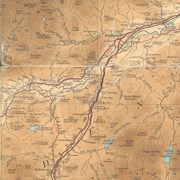
Galleries | B848 (Laggan - Dalwhinnie) | A889 | A9/Strathspey | Newtonmore | A86 | Bartholomews Mapping | ||
File history
Click on a date/time to view the file as it appeared at that time.
| Date/Time | Thumbnail | Dimensions | User | Comment | |
|---|---|---|---|---|---|
| current | 12:17, 25 November 2009 | | 768 × 770 (221 KB) | Rileyrob (talk | contribs) | {{Information |description = The B848 before it was replaced by the A889 |day = |month = |year = c1925 |photographer = |source = Batholomew's Half Inch Sheet 16 |road = B848 |road2 = A889 |road3 = A9 |
File usage
The following 4 pages use this file: