File:Beckington-1959.jpg
Jump to navigation
Jump to search

Size of this preview: 583 × 600 pixels. Other resolution: 627 × 645 pixels.
Original file (627 × 645 pixels, file size: 139 KB, MIME type: image/jpeg)
| |||||||||||||||||||||||||
|
Galleries | A36 | A361 | OS One Inch | ||
File history
Click on a date/time to view the file as it appeared at that time.
| Date/Time | Thumbnail | Dimensions | User | Comment | |
|---|---|---|---|---|---|
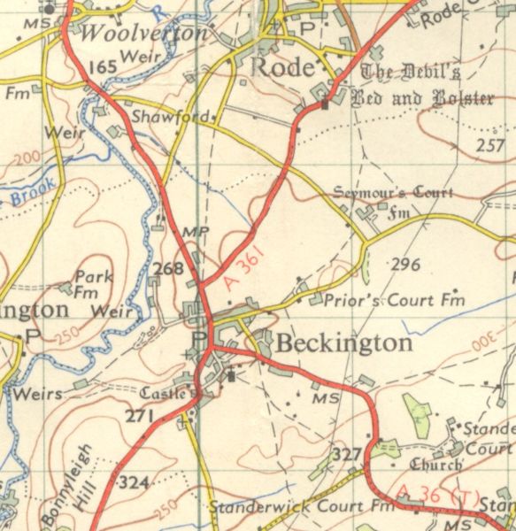
| current | 08:25, 1 January 2010 | | 627 × 645 (139 KB) | Rileyrob (talk | contribs) | {{Information |description = Beckington in 1959, showing the A36 and A361 multiplexing through the village before it was bypassed. |day = |month = |year = 1959 |photographer = |source = OS 7th Sheet 166 |road = A3 |
File usage
There are no pages that use this file.