No higher resolution available.
 | |  |
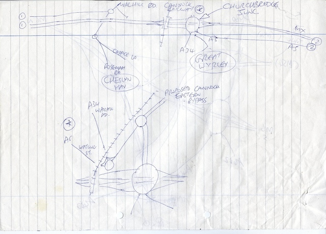
| | Description: | Birmingham Northern Relief Road Detailed Plan 1987 Part 2 of 10
Originally uploaded to Coppermine on Jul 27, 2007 by gepree68 | | Location: | This picture currently has no coords, edit this page to add them. | | Road: | M6 Toll, A446(M) | | Date: | 2007 | | Photographer: | Gepree68 | | Source: | Coppermine |
| |
 | |  |
File history
Click on a date/time to view the file as it appeared at that time.
| Date/Time | Thumbnail | Dimensions | User | Comment |
|---|
| current | 13:53, 17 May 2010 |  | 640 × 459 (128 KB) | Si404 (talk | contribs) | '''Birmingham Northern Relief Road Detailed Plan 1987 Part 2 of 10'''
<small>''Originally uploaded to Coppermine on Jul 27, 2007 by gepree68''</small> |
File usage
The following page uses this file:
This file contains additional information, probably added from the digital camera or scanner used to create or digitise it.
If the file has been modified from its original state, some details may not fully reflect the modified file.
