File:Carlisle city centre - Geograph - 1731484.jpg
Jump to navigation
Jump to search

No higher resolution available.
Carlisle_city_centre_-_Geograph_-_1731484.jpg (640 × 452 pixels, file size: 108 KB, MIME type: image/jpeg)
| |||||||||||||||||||||||||
|
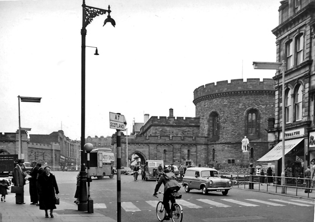
Galleries | A6 | A7 | Carlisle | Pre-Worboys Direction Signs | ||
File history
Click on a date/time to view the file as it appeared at that time.
| Date/Time | Thumbnail | Dimensions | User | Comment | |
|---|---|---|---|---|---|
| current | 00:32, 15 March 2010 | | 640 × 452 (108 KB) | Jeni (talk | contribs) | '''Carlisle city centre'''<br/>Northward at Botchergate; Court House to right. |
File usage
The following page uses this file: